Being Enclosed as a Lifestyle: Complex Neolithic Settlements of Eastern Croatia Re-Evaluated through Aerial and Magnetic Survey


Abstract
:1. Introduction
2. Materials and Methods
2.1. Excavations
2.2. Geomagnetic Survey
3. Results
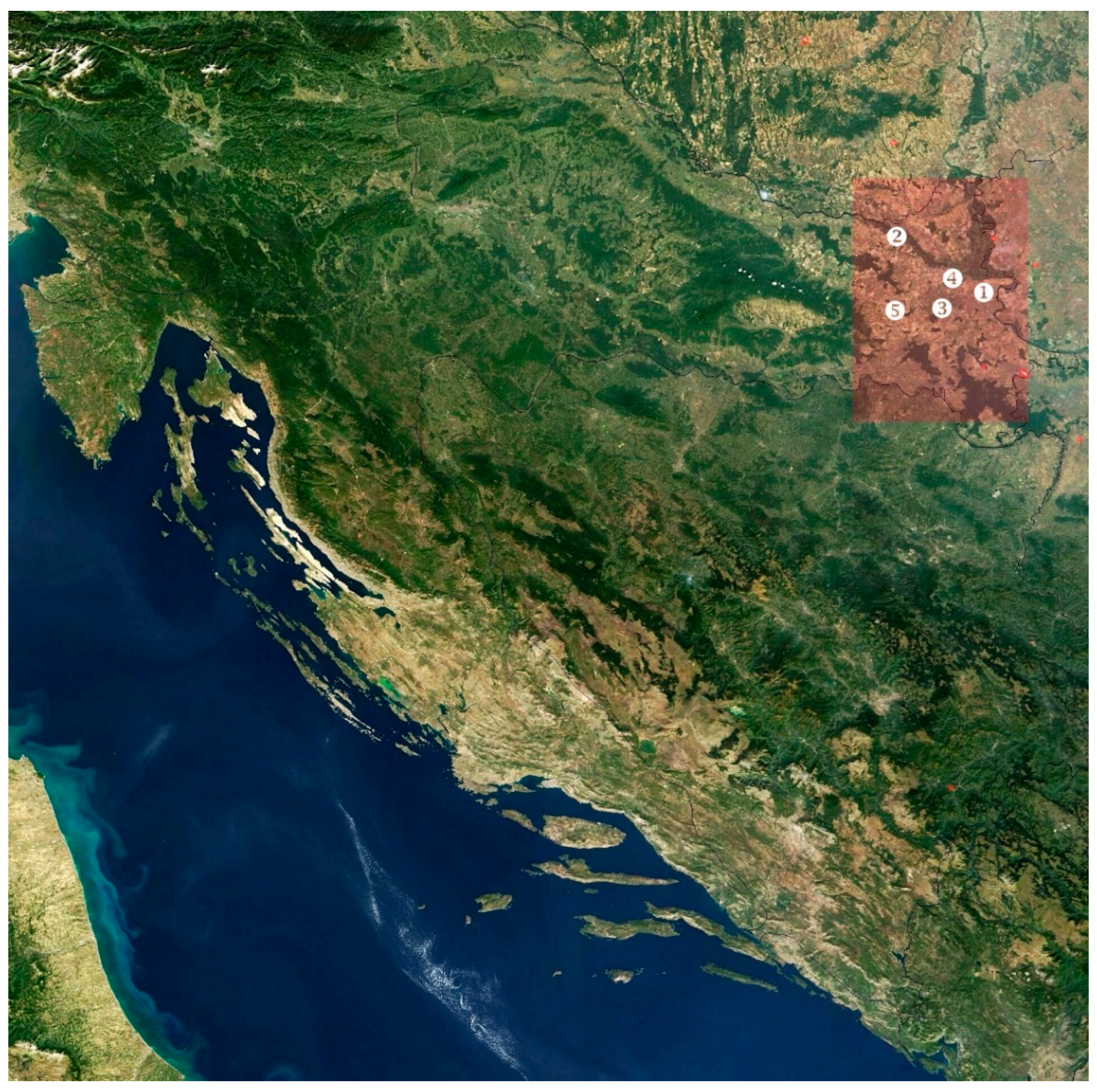
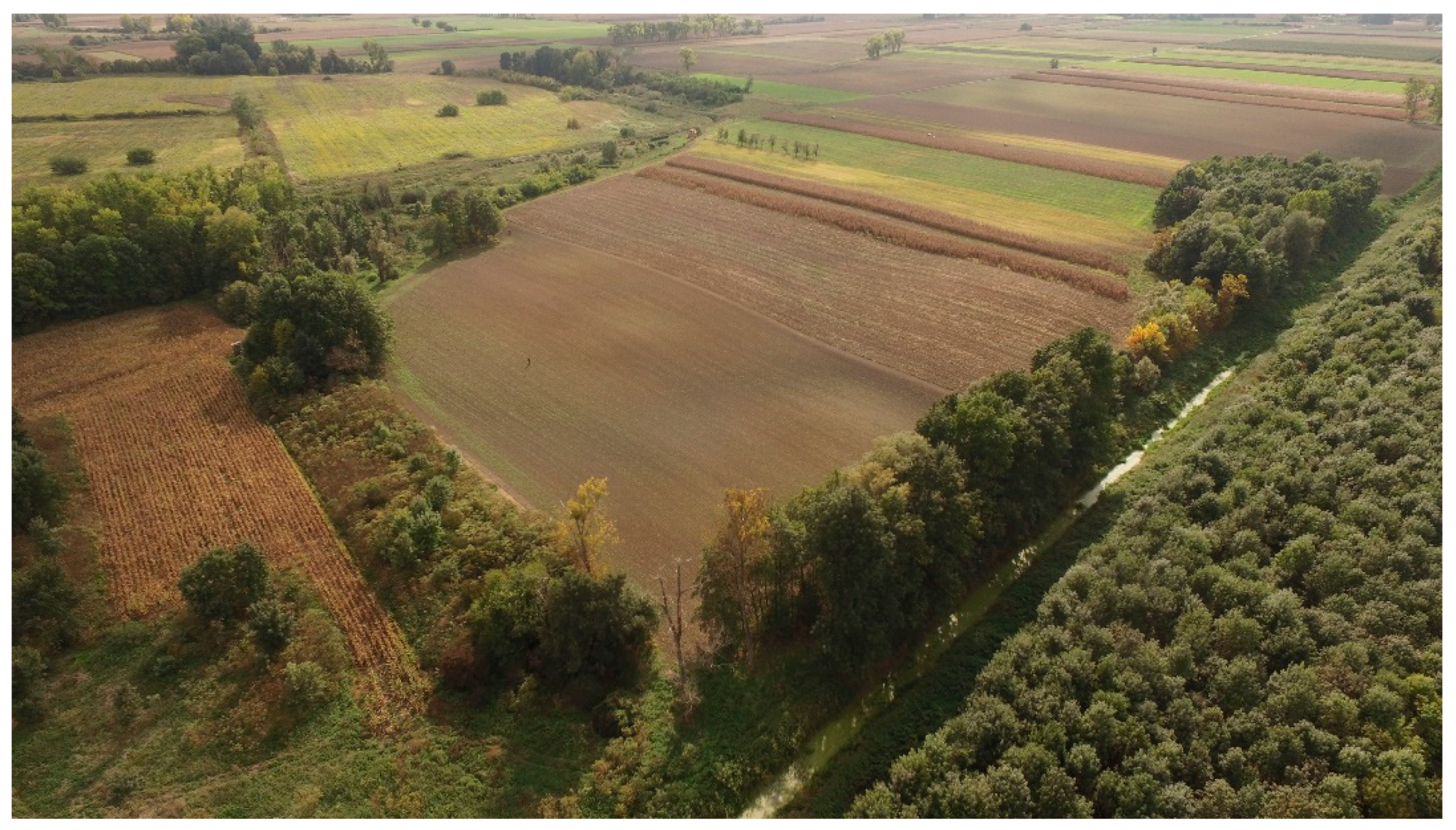
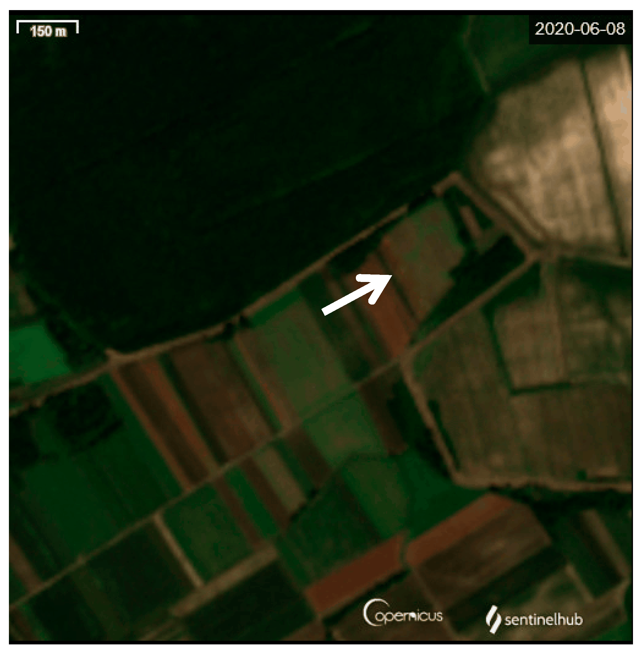
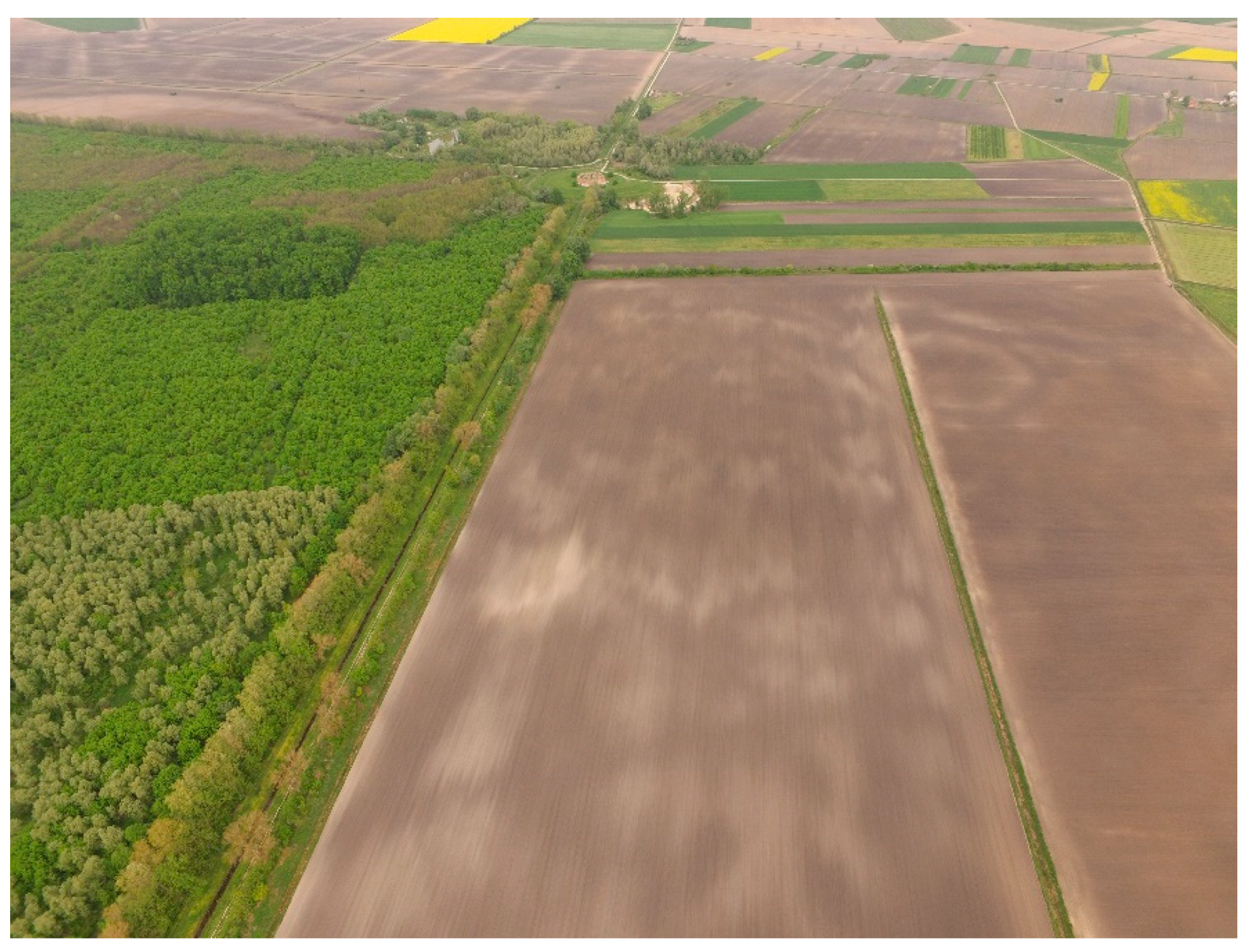
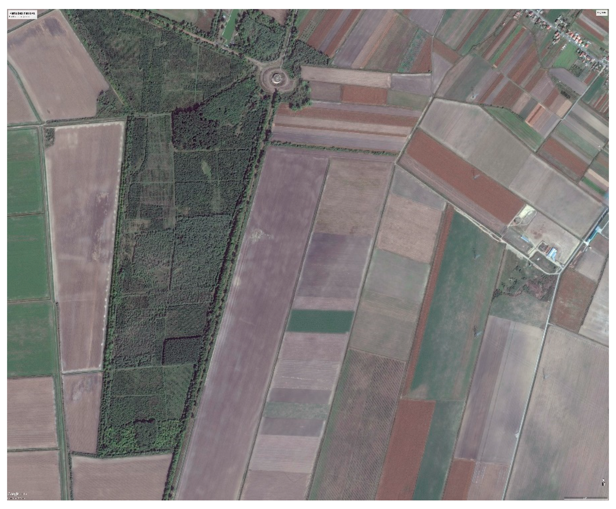
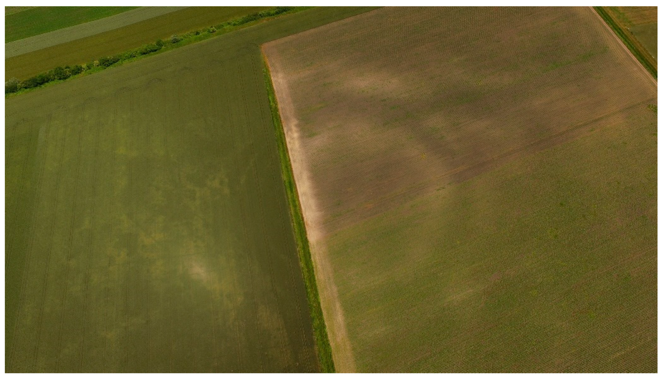
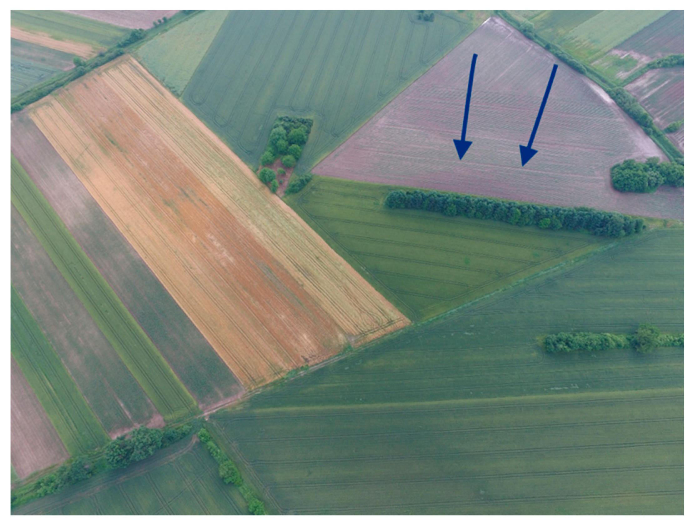
- Research area
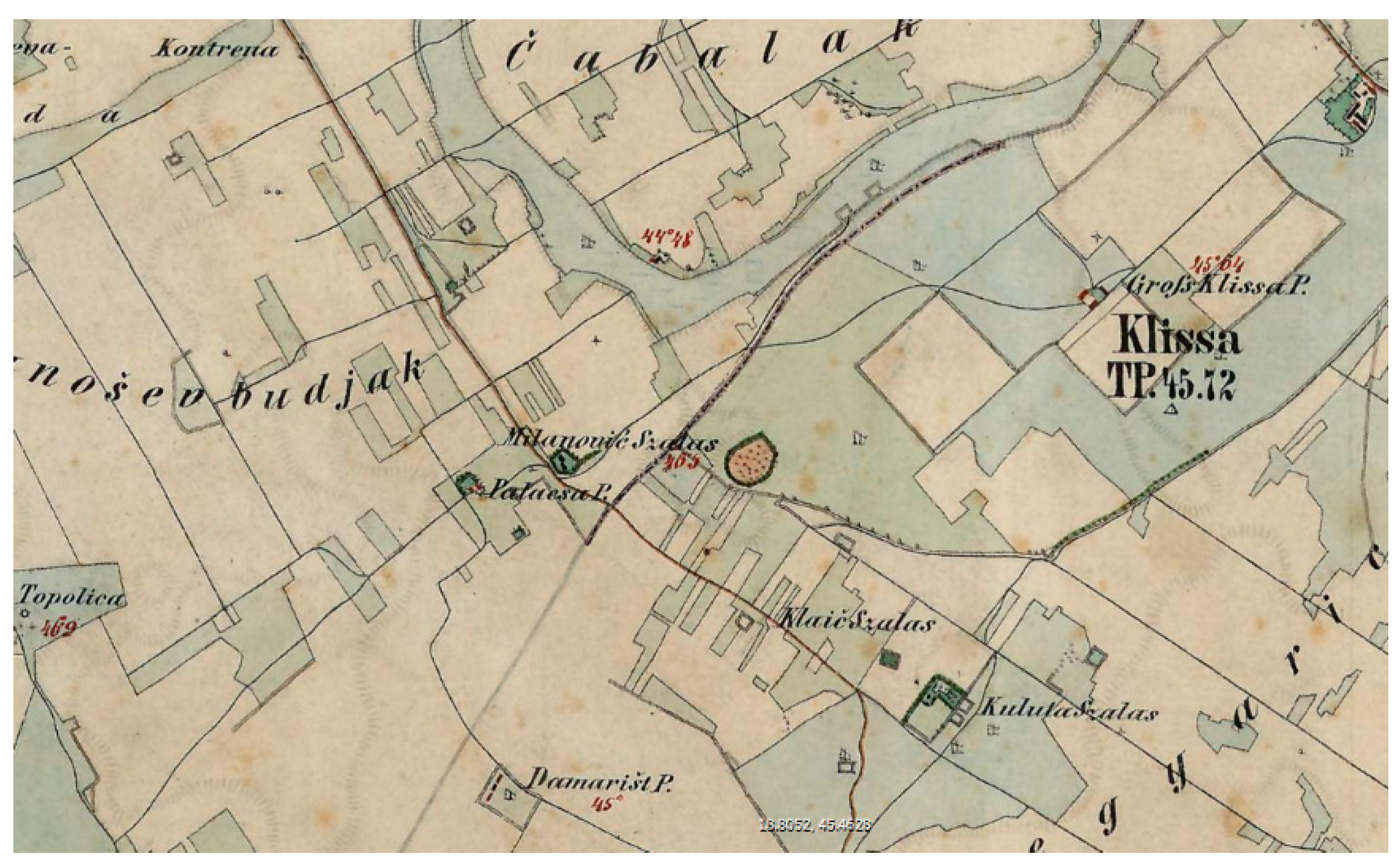
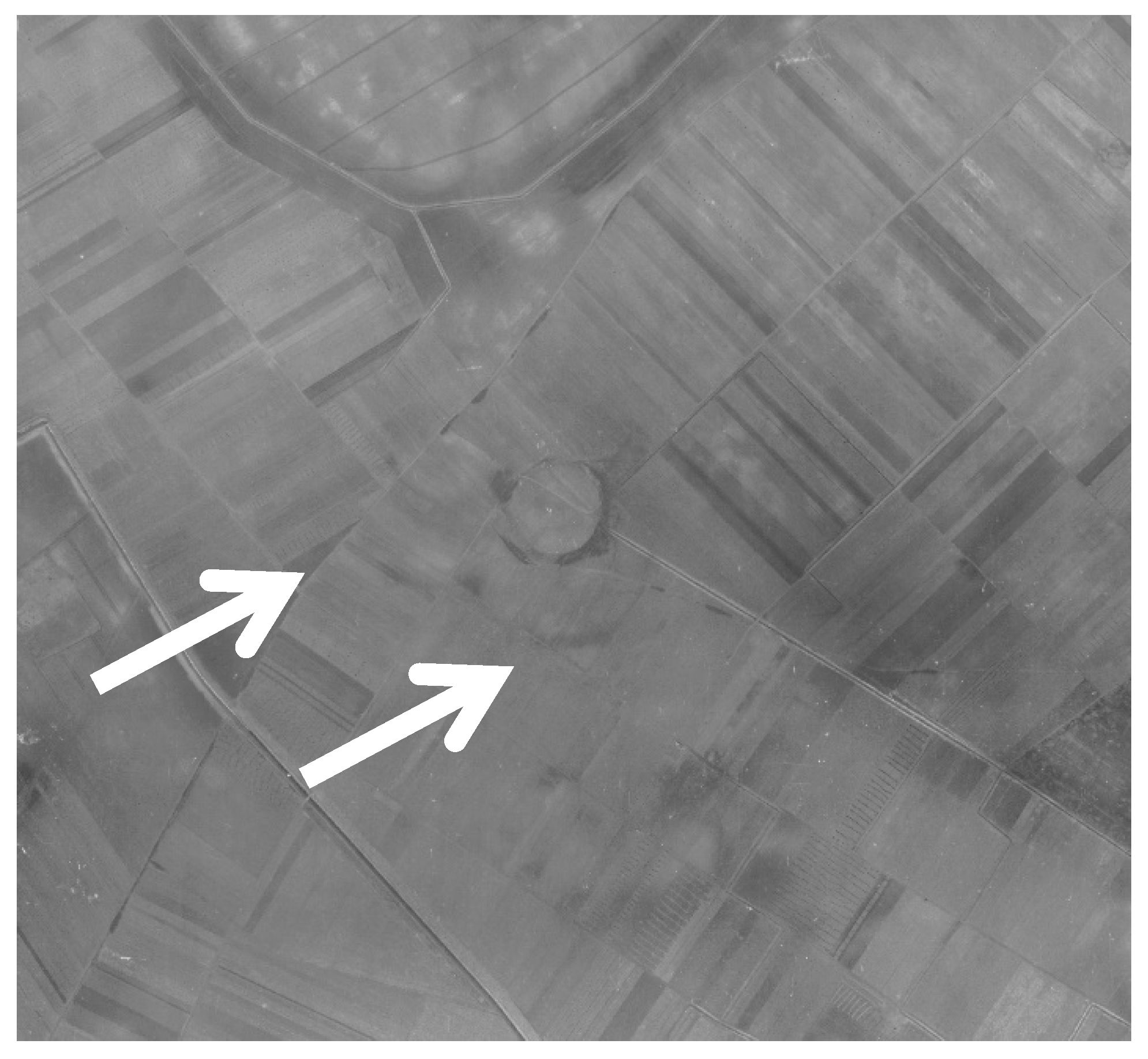
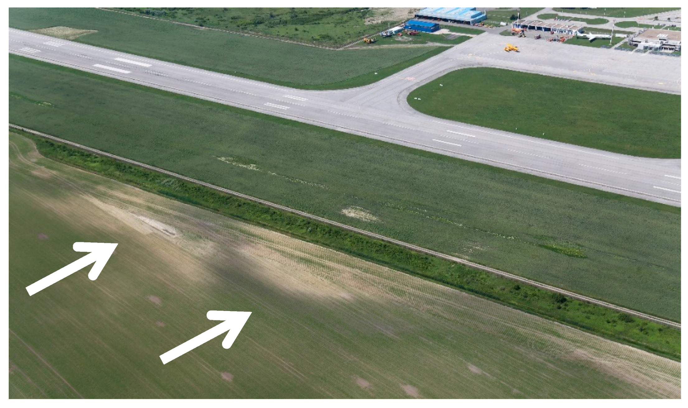
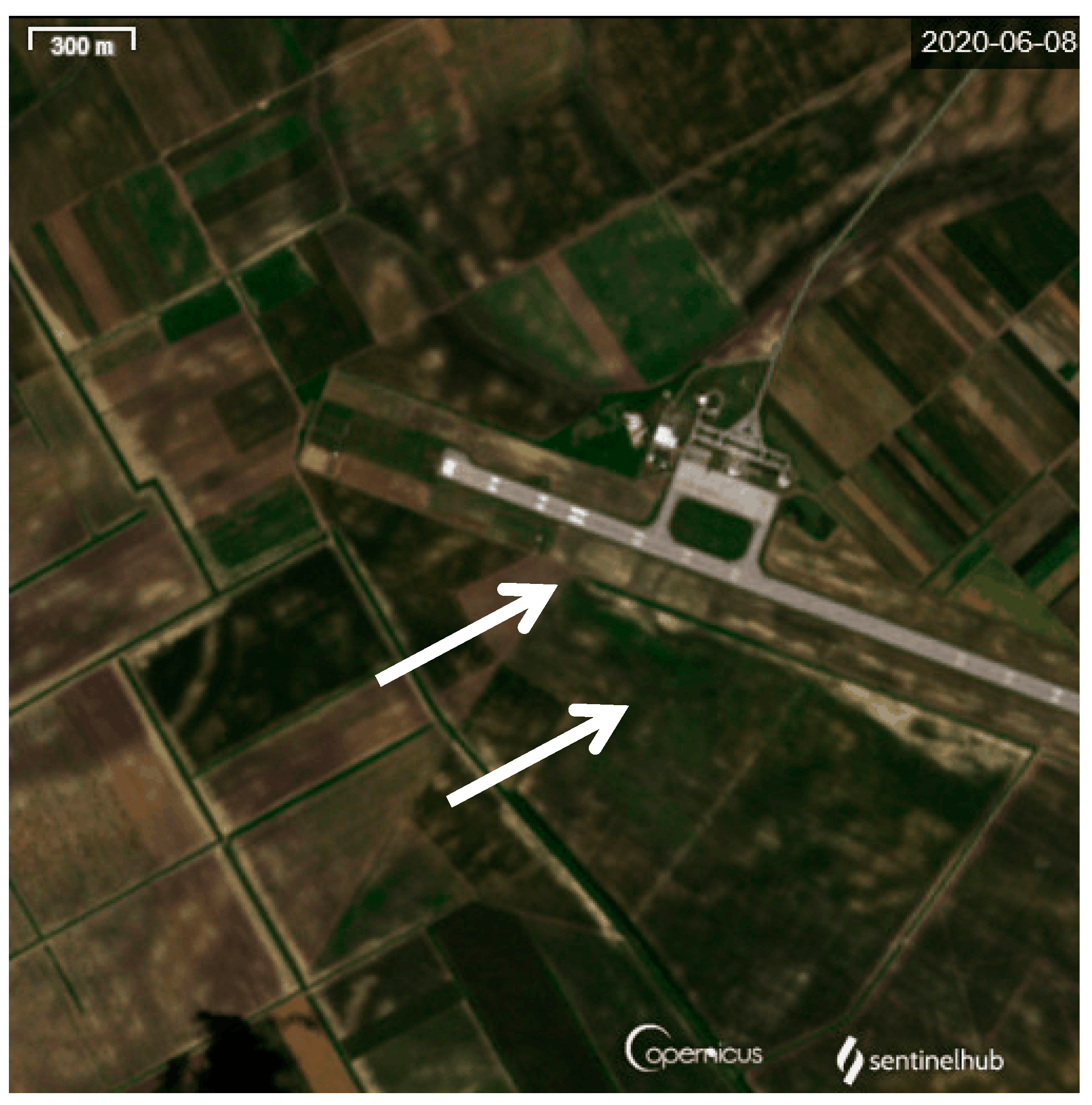
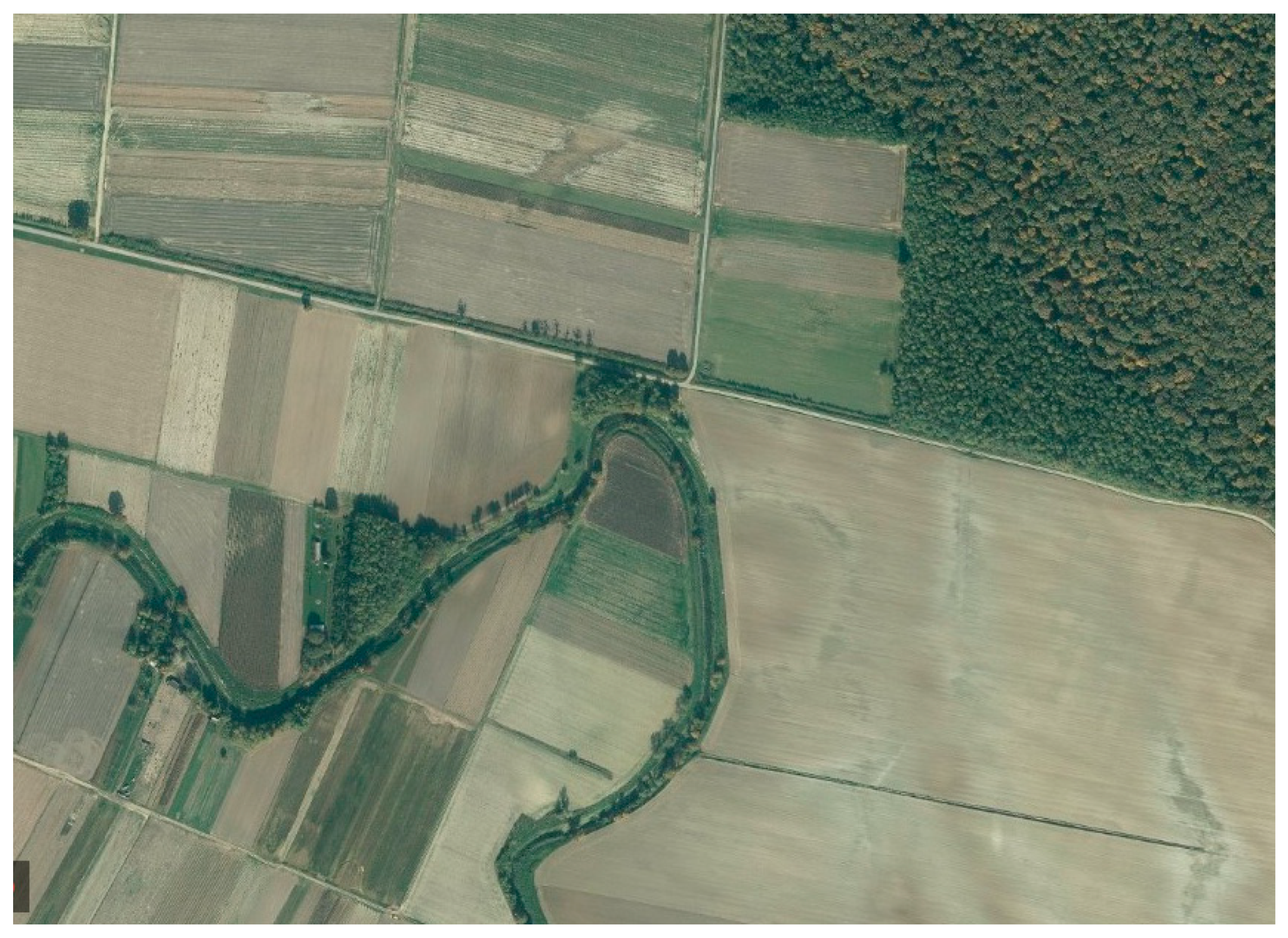
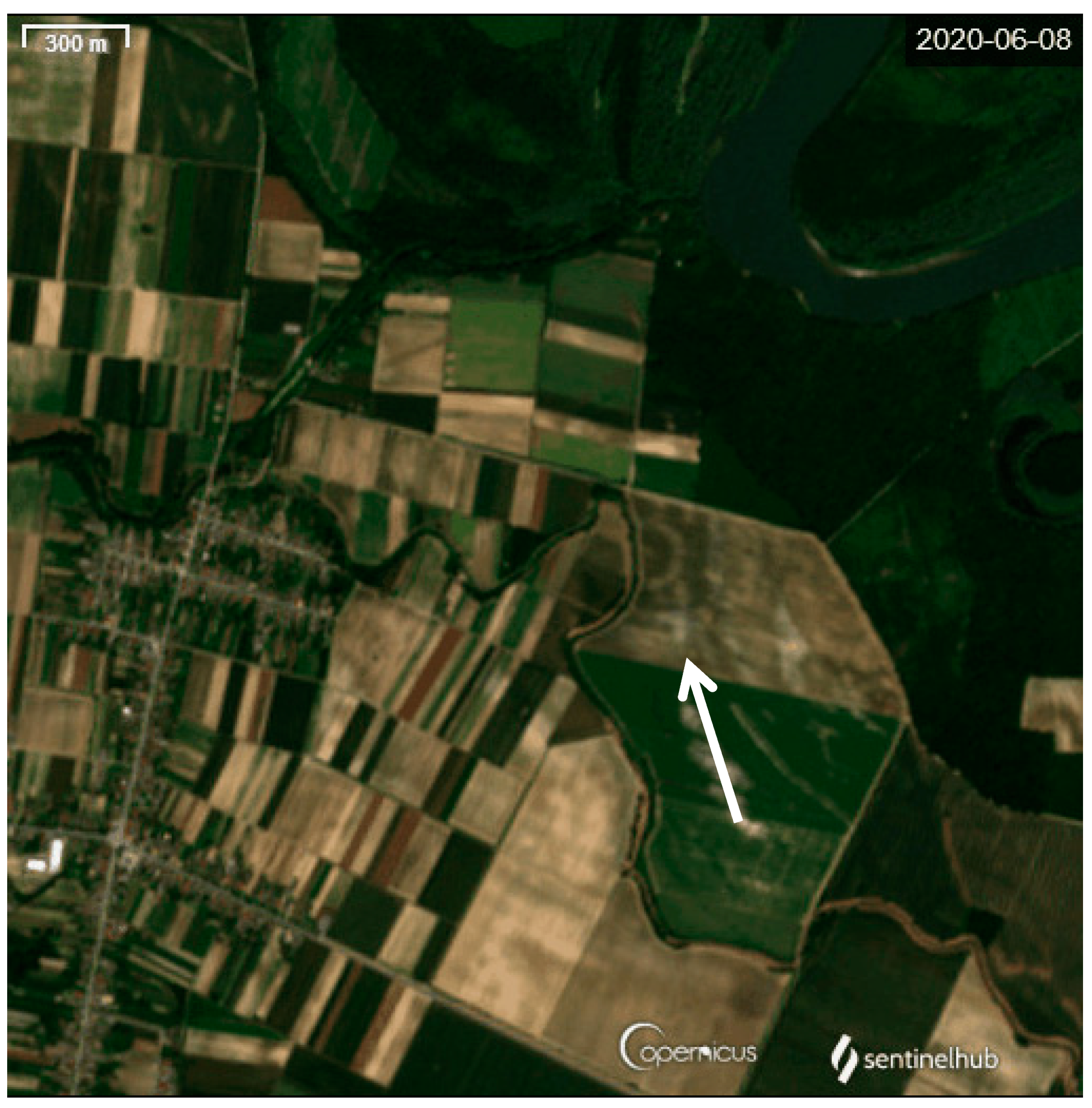
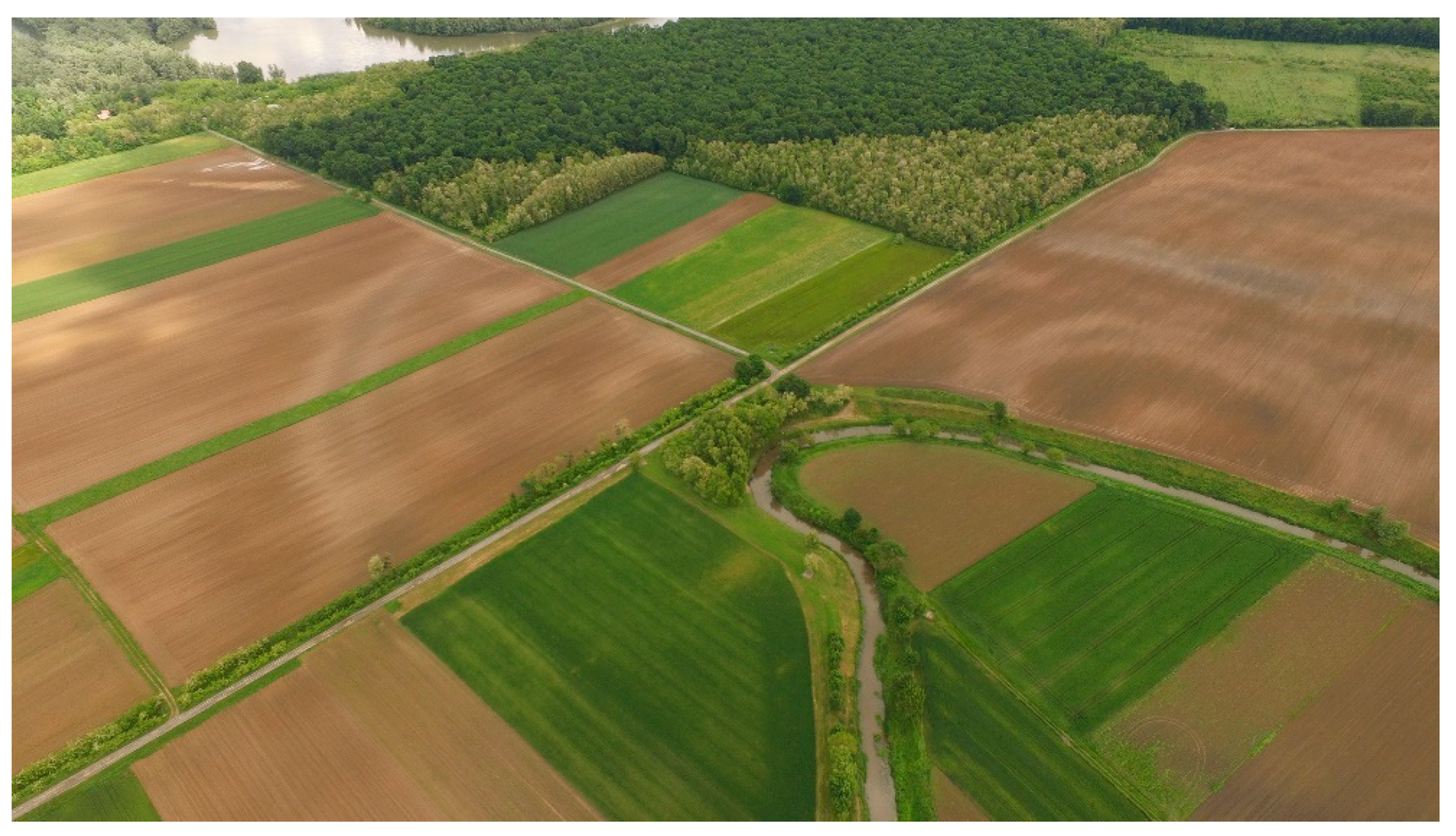
3.1. Klisa
3.2. Gat-Svetošince
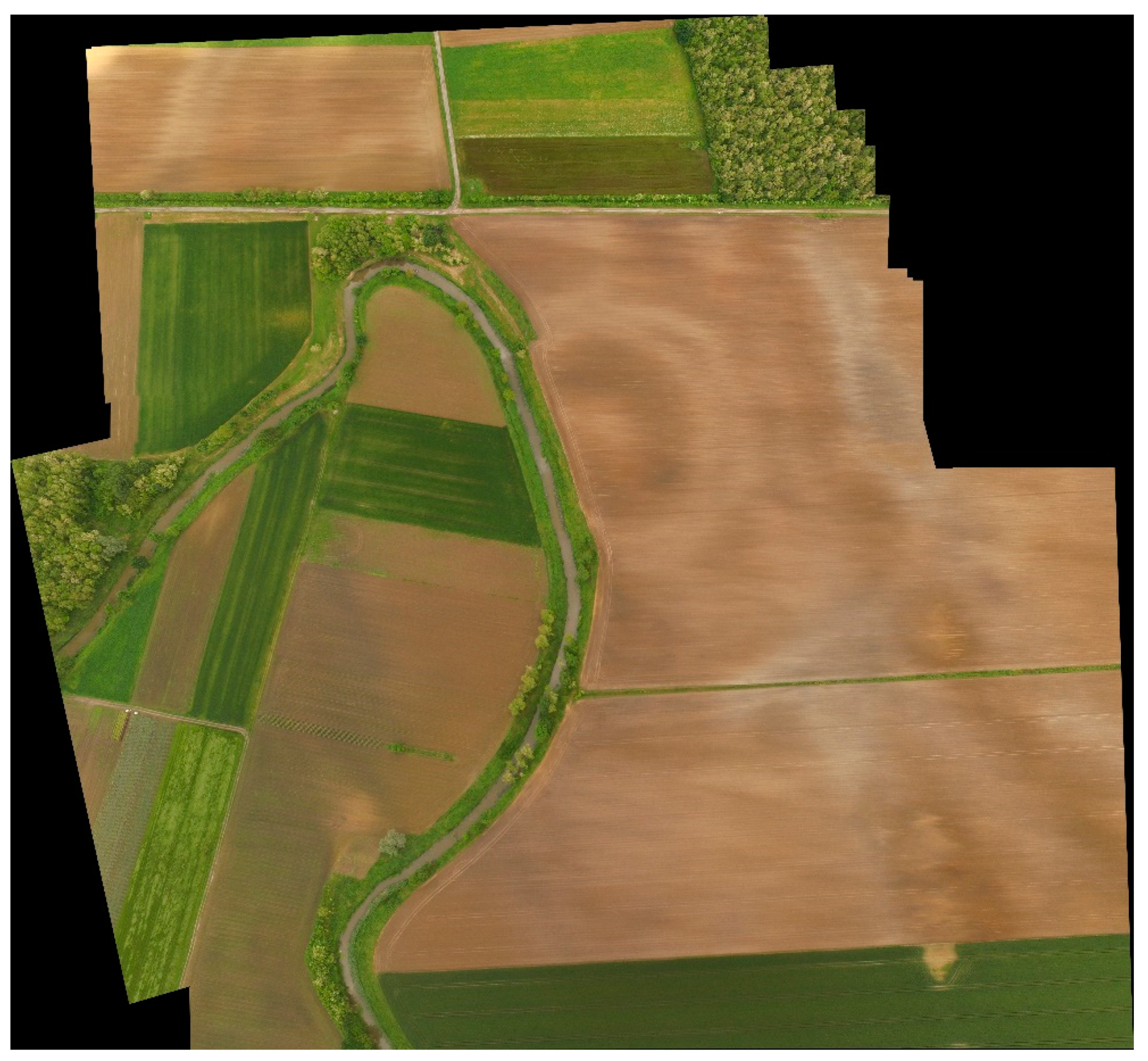
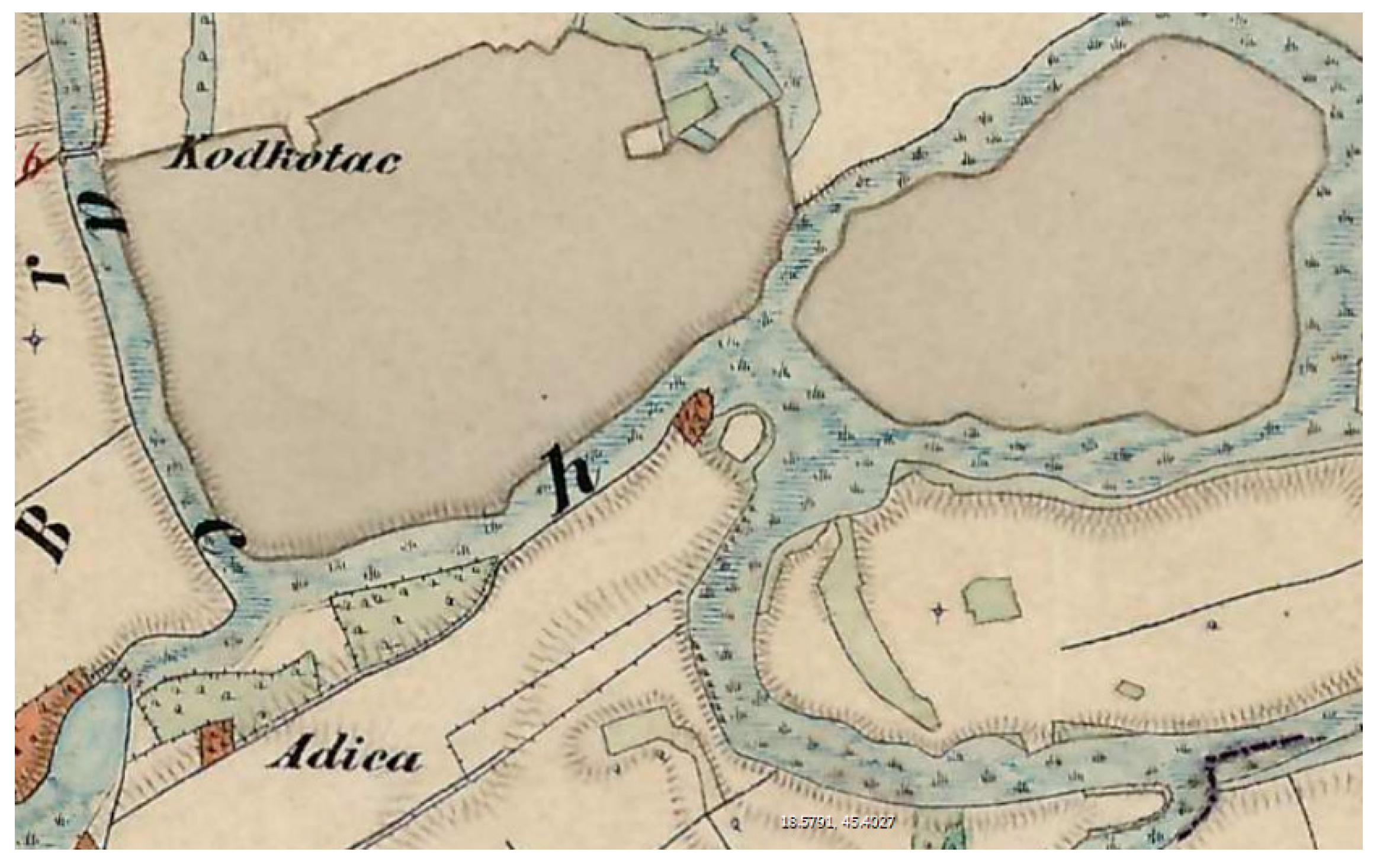
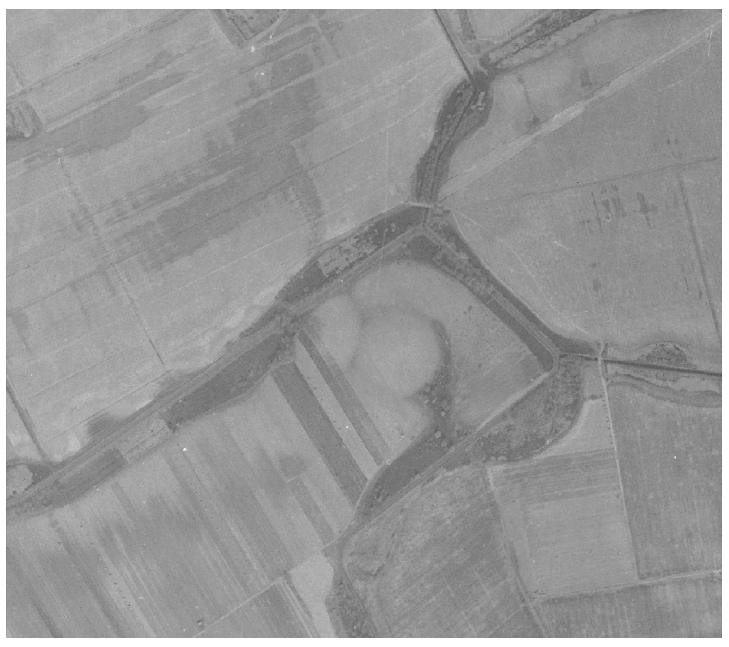
3.3. Koritna-Pašnik
3.4. Ivanovac-Korođvar
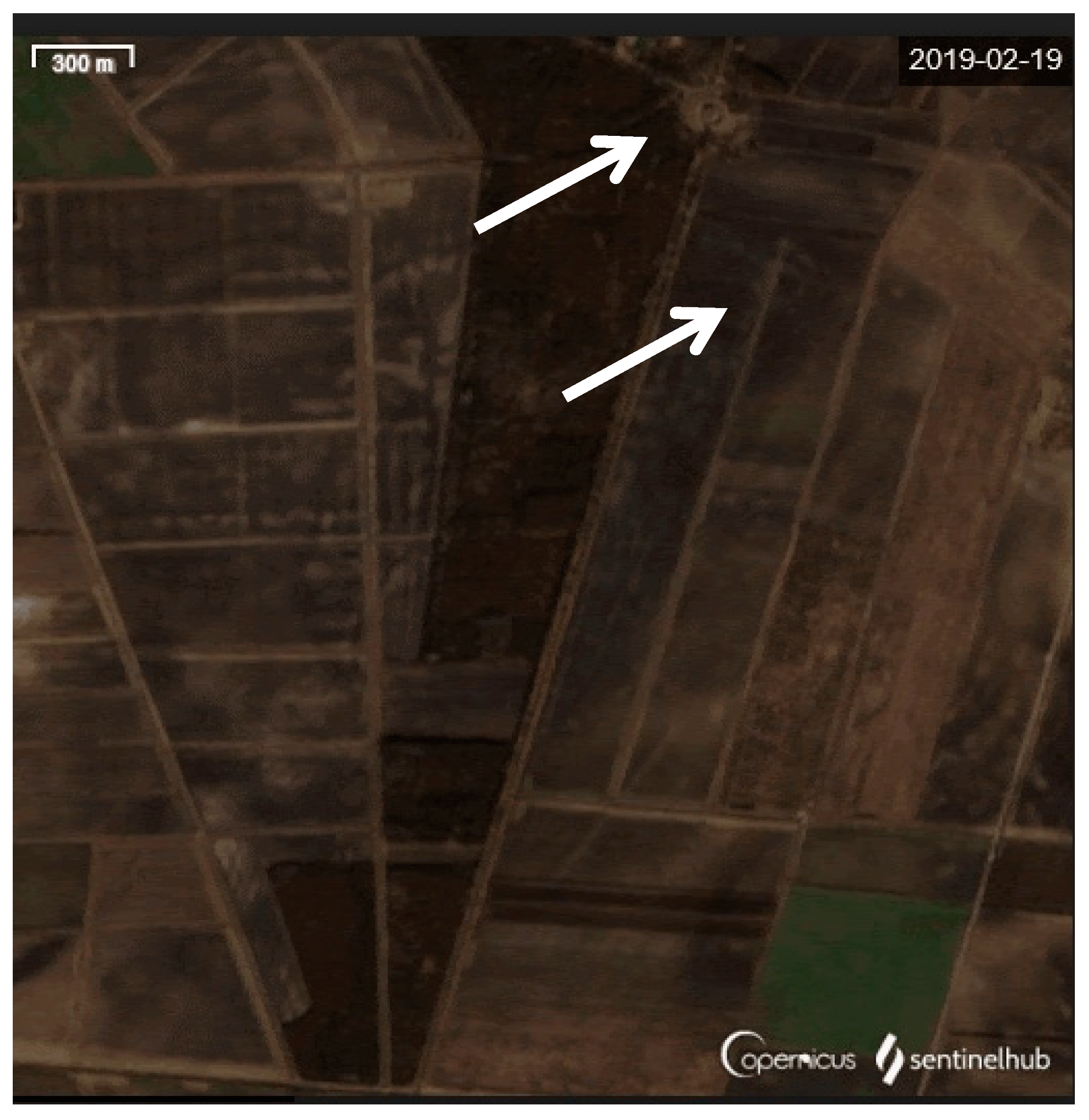
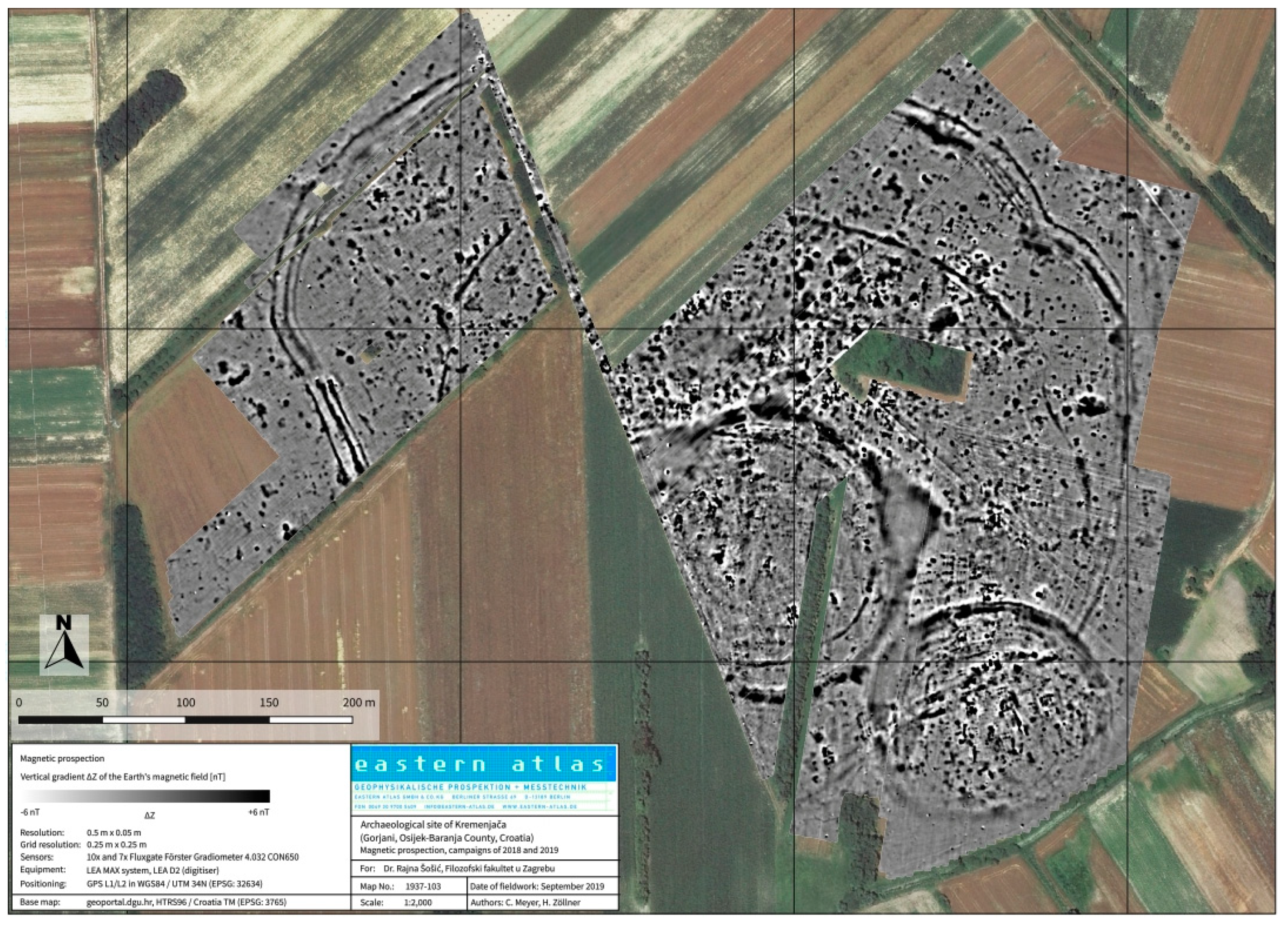
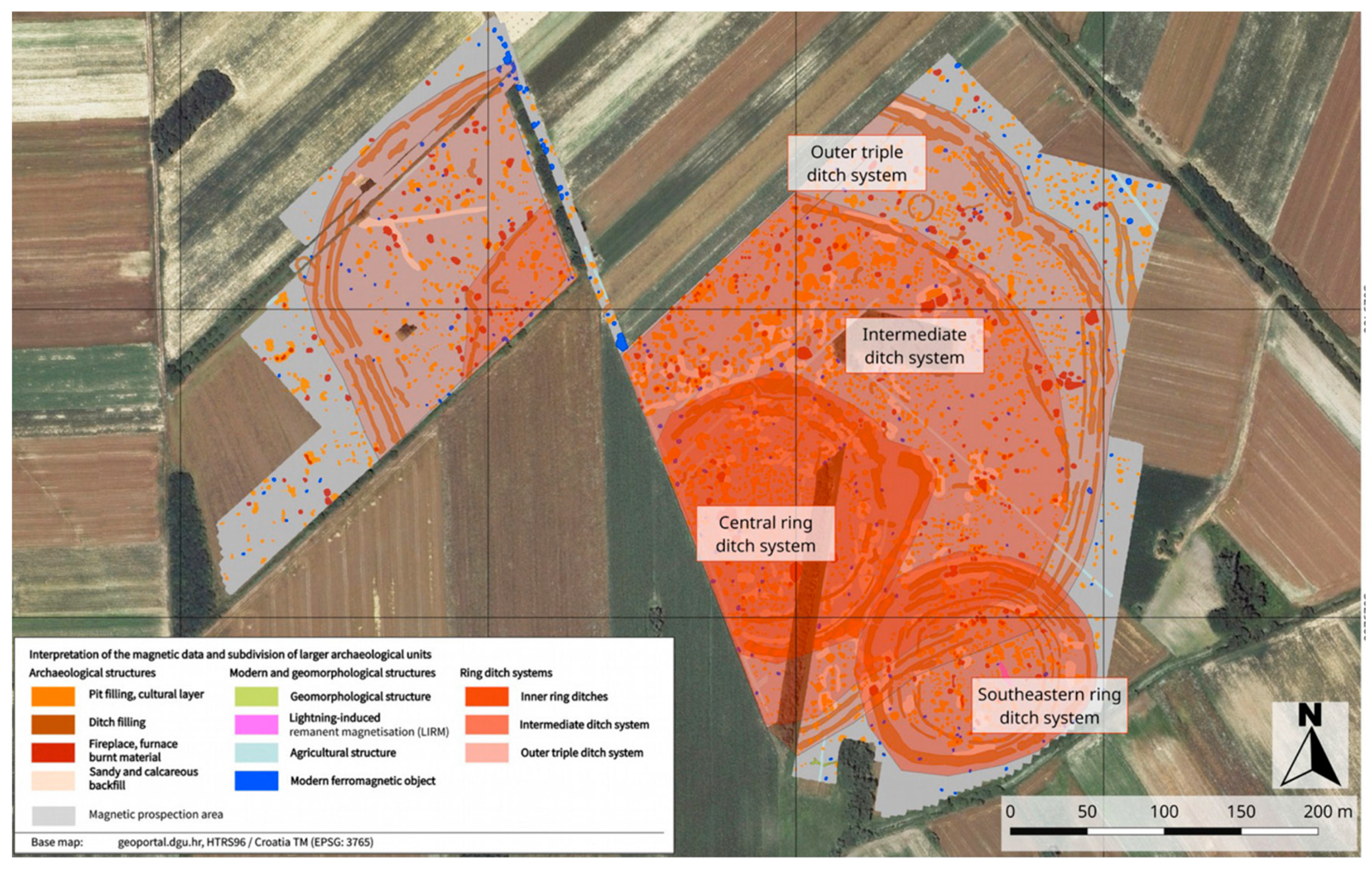
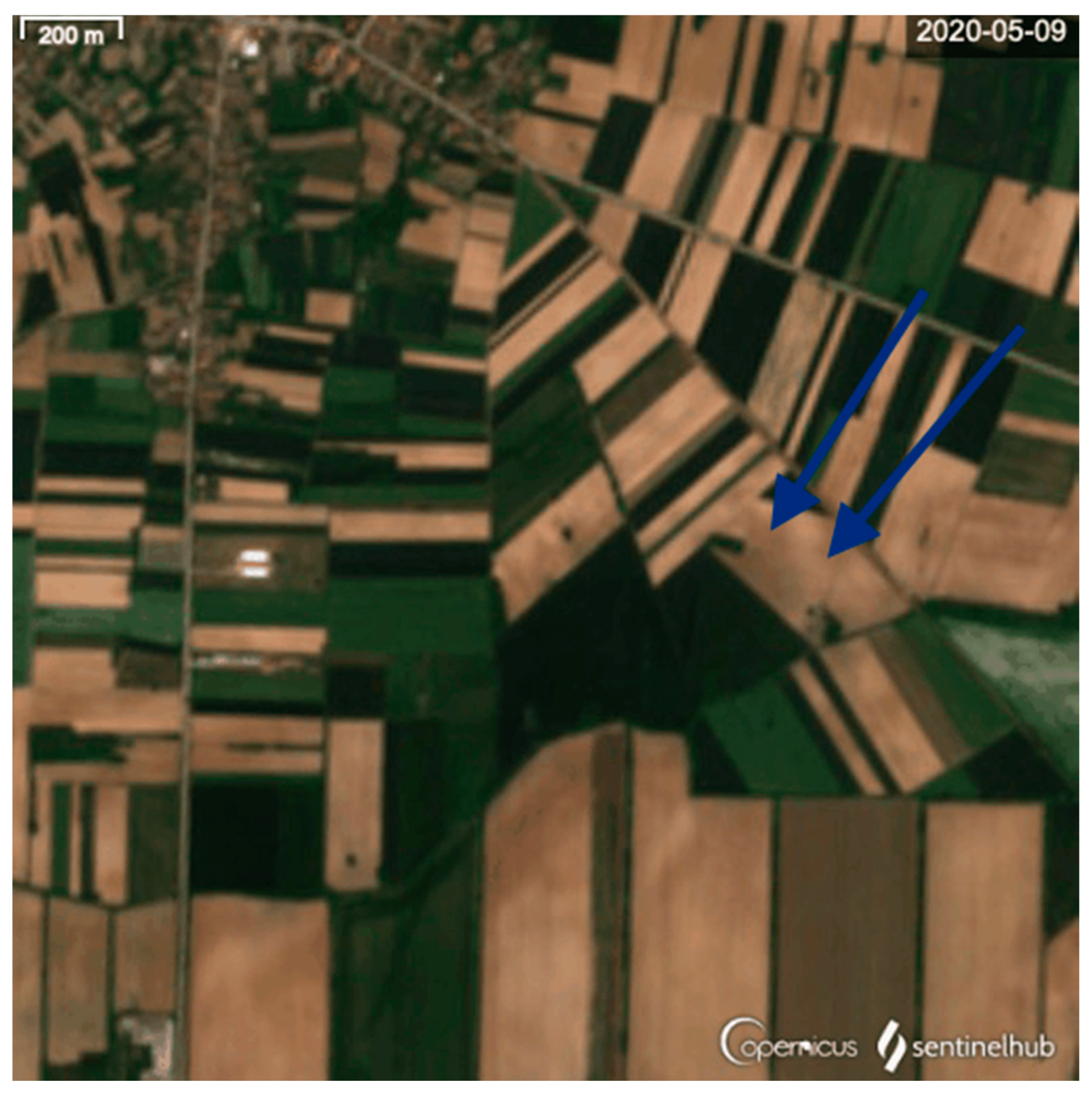
3.5. Gorjani-Kremenjača
4. Discussion
Author Contributions
Funding
Acknowledgments
Conflicts of Interest
References
- Marković, Z. Novija razmatranja o nekim aspektima sopotske kulture u sjevernoj Hrvatskoj/Neuere Betrachtungen über bestimmte Aspekte der Sopot-Kultur in Nordkroatien. Prilozi Instituta za arheologiju u Zagrebu 2012, 29, 57–69. [Google Scholar]
- Balen, J.; Čataj, L. Sopotska kultura. In Darovi Zemlje, Neolitik Između Save, Drave i Dunava; Balen, J., Hršak, T., Šošić Klindžić, R., Eds.; Arheološki Muzej u Zagrebu, Muzej Slavonije, Filozofski Fakultet Sveučilišta u Zagrebu: Zagreb, Croatia, 2014; pp. 59–73. [Google Scholar]
- Botić, K. Neolitička Naselja na Prostoru Sjeverne Hrvatske. Ph.D. Thesis, Sveučilište u Zagrebu, Zagreb, Croatia, 2017. [Google Scholar]
- Petrasch, J. Mittelneolitische Kreisgrabenanlagen in Mitteleuropa. Ber. der RG Komm. 1990, 71, 407–564. [Google Scholar]
- Melichar, P.; Neubauer, W. (Eds.) Mittelneolithische Kreisgrabenanlagen in Niederösterreich: Geophysikalisch-archäologische Prospektion; ein Interdisziplinäres Forschungsprojekt, Mitteilungen der Prähistorischen Kommission/Österreichische Akademie der Wissenschaften, Philosophisch-Historische Klasse (Bd. 71); Österreichische Akademie der Wissenschaften (ÖAW): Wien, Austria, 2010. [Google Scholar]
- Literski, N.; Nebelsick, L.D. Katalog der Kreisgrabenanlagen und verwandten Tells der ersten Hälfte des 5. Jt. v. Chr. in Mittel- und Südosteuropa. In Neolithische Kreisgrabenanlagen in Europa. Neolithic Circular Enclosures in Europe, Proceedings of Internationale Arbeitstagung, Goseck, Germany, 7–9 May 2004; Bertemes, F., Meller, H., Eds.; Landesamt für Denkmalpflege und Archäologie Sachsen-Anhalt, Landesmuseum für Vorgeschichte: Halle (Saale), Germany, 2012; pp. 433–507. [Google Scholar]
- Řídký, J.; Květina, P.; Limburský, P.; Končelová, M.; Burgert, P.; Šumberová, R. Big Men or Chiefs?: Rondel Builders of Neolithic Europe; Oxbow Books: Oxford, UK, 2019. [Google Scholar]
- Pasztor, E.; Barna, J.P.; Zotti, G. Neolithic Circular Ditch systems (“Rondels”) in Central europe. In Handbook of Archaeoastronomy and Ethnoastronomy; Ruggls, C.N., Ed.; Springer: New York, NY, USA, 2015; pp. 1317–1326. [Google Scholar] [CrossRef]
- Kalafatić, H.; Šiljeg, B. TWIN CIRCLES: New insights in the Neolithic settlment pattern/KRUGOVI PARNJACI: Novi uvidi u neolitičke obrasce naseljavanja. Pril. Inst. za Arheol. u Zagrebu 2018, 35, 71–111. [Google Scholar] [CrossRef]
- Šošić Klindžić, R.; Kalafatić, H.; Šiljeg, B.; Hršak, T. Circles and ceramics through the centuries: Characteristics of Neolithic Sopot culture settlements/Krugovi i keramika kroz stoljeća: Značajke naselja sopotske kulture. Pril. Inst. za Arheol. u Zagrebu 2019, 36, 41–84. [Google Scholar] [CrossRef] [Green Version]
- Sentinel 2. Available online: https://sentinel.esa.int/web/sentinel/missions/sentinel-2 (accessed on 8 June 2020).
- Agatou, A.; Alexakis, D.D.; Sarris, A.; Hadjimitsis, D.G. Evaluating the Potentials of Sentinel-2 for Archaeological Perspective. Remote. Sens. 2014, 6, 2176–2194. [Google Scholar] [CrossRef] [Green Version]
- Tapete, D.; Cigna, F. Appraisal of opportunities and perspectives for the systematic condition assessment of heritage sites with copernicus sentinel-2 high-resolution multispectral imagery. Remote. Sens. 2018, 10, 561. [Google Scholar] [CrossRef] [Green Version]
- Šiljeg, B.; Kalafatić, H. Zračno rekognosciranje, Osječkobaranjska županija 2015. godine. Ann. Inst. Archaeol. 2016, 12, 213–222. [Google Scholar]
- Geoportalu Države Geodetske Uprave. Available online: https://geoportal.dgu.hr/ (accessed on 21 April 2020).
- Mapire–The Historical Map Portal. Available online: https://mapire.eu/en/ (accessed on 22 April 2020).
- Mušić, B.; Matijević, F.; Basar, P. Izvješće o Geofizičkim Istraživanjima na Lokalitetu Gorjani—Kremenjača, Technical Field Report. 2016.
- Meyer, C.; Hypiak, V. Magnetic prospection at the Neolithic site of Kremenjača in Gorjani (Đakovo, Osijek-Baranja County, Croatia), Technical Field Report. 2018.
- Meyer, C.; Zöllner, H. Magnetic prospection at the Neolithic site of Kremenjača in Gorjani (Đakovo, Osijek-Baranja County, Croatia), Campaign of 2019, Technical Field Report. 2019.
- Šiljeg, B.; Kalafatić, H. Zračna arheologija u istočnoj Slavoniji 2014. Godine. Ann. Inst. Archaeol. 2015, 11, 135–141. [Google Scholar]
- Kalafatić, H.; Šiljeg, B. Everything fears time, but time fears the circles: 7 thousand years old prehistoric enclosures in landscape of the southern Carpathian Basin. In Cracow Landscape Conference, Landscape as Impulsion for Culture: Research, Perception and Protection, Kraków, Poland, 29 June 2016–1 July 2016; Kołodziejczyk, P., Kwiatkowska-Kopka, B., Eds.; Institute of Archeology Jagiellonian University in Krakow, Institute of Landscape Architecture Cracow University of Technology: Kraków, Poland, 2016. [Google Scholar]
- Google Earth Pro. Available online: kh.google.com (accessed on 1 April 2020).
- Miko, S.; Ilijanić, N. Izvješće s Terenskog Istraživanja na Arheološkom Lokalitetu Gorjani kod Đakova-sopotska Kultura; Field Report; Hrvatski Geološki Institute: Zagreb, Croatia, 2019. [Google Scholar]
- Hofmann, R.; Medović, A.; Furholt, M.; Medović, I.; Pešterac, T.S.; Dreibrodt, S.; Martini, S.; Hofmann, A. Late Neolithic multicomponent sites of the Tisza region and the emergence of centripetal settlement layouts. Praehist. Z. 2020, 95, 305–309. [Google Scholar] [CrossRef]
- 2018_Raczky, Pál: A Complex Monument in the Making at the Late Neolithic Site of Polgár-Csőszhalom (Hungary). In ACROSS THE MEDITERRANEAN—ALONG THE NILE Studies in Egyptology, Nubiology and Late Antiquity Dedicated to László Török on the Occasion of His 75th Birthday; Bács, A.T.; Bollók, Á.; Vida, T. (Eds.) Institute of Archaeology, Research Centre for the Humanities Hungarian Academy of Sciences: Budapest, Hungary, 2018; pp. 15–60. [Google Scholar]
- Raczky, P.; Füzesi, A. Öcsöd-Kováshalom. A retrospective look at the interpretations of a Late Neolithic site. Diss. Archaeol. 2017, 3, 9–42. [Google Scholar] [CrossRef]
- Bertók, G.; Gáti, C. Old Times–New Methods: Non-Invasive Archaeology in Baranya County (Hungary), 2005–2013; Archaeolingua: Budapest, Hungary, 2014. [Google Scholar]
- Barna, P.J.; Tokai, Z.M.; Pásztor, E.; Eke, I.; Puszta, S.; Puszta, A.; Busznyák, J.; Biró, T.K.; Száraz, C. Late Neolithic Circular Ditch Systems. In Western-Hungary. Centenary of Jaroslav Palliardi’s Neolithic and Aeneolithic Relative Chronology (1914–2014); Kovárník, J., Ed.; Hradec Králové, Czech Republic, 2016. pp. 309–336. Available online: https://www.researchgate.net/publication/309742593 (accessed on 22 April 2020).
- Křivánek, R. The contribution of new geophysical measurements at the previously excavated Neolithic rondel area near Bylany, central Bohemia. Archaeol. Prospect. 2020, 27, 39–52. [Google Scholar] [CrossRef]


| Site | Type | Area/ha | No of Enclosed Spaces |
|---|---|---|---|
| Klisa | twin | 12 + 8 | 4 |
| Gat Svetošince | twin | 22 | 3 |
| Koritna | multiple | 3.56 | 5 |
| Korođvar | multiple | 8.2 | 6 |
| Gorjani Kremenjača | multiple | 20 | 3 |
© 2020 by the authors. Licensee MDPI, Basel, Switzerland. This article is an open access article distributed under the terms and conditions of the Creative Commons Attribution (CC BY) license (http://creativecommons.org/licenses/by/4.0/).
Share and Cite
Kalafatić, H.; Klindžić, R.Š.; Šiljeg, B. Being Enclosed as a Lifestyle: Complex Neolithic Settlements of Eastern Croatia Re-Evaluated through Aerial and Magnetic Survey. Geosciences 2020, 10, 384. https://0-doi-org.brum.beds.ac.uk/10.3390/geosciences10100384
Kalafatić H, Klindžić RŠ, Šiljeg B. Being Enclosed as a Lifestyle: Complex Neolithic Settlements of Eastern Croatia Re-Evaluated through Aerial and Magnetic Survey. Geosciences. 2020; 10(10):384. https://0-doi-org.brum.beds.ac.uk/10.3390/geosciences10100384
Chicago/Turabian StyleKalafatić, Hrvoje, Rajna Šošić Klindžić, and Bartul Šiljeg. 2020. "Being Enclosed as a Lifestyle: Complex Neolithic Settlements of Eastern Croatia Re-Evaluated through Aerial and Magnetic Survey" Geosciences 10, no. 10: 384. https://0-doi-org.brum.beds.ac.uk/10.3390/geosciences10100384