1. Introduction
Humanity has changed due to natural processes over the last millennium. The activities led to landscape and territory transformation, changes in the ecology, and their interconnections [
1,
2,
3].
The presence of elements and natural values in the city today is a fundamental condition for environmental recovery of the urban territory. The natural and urban systems are part of the same space whose integrated management is the regional space requirement and a condition of sustainability of territories and cities. Moreover, the agroforestry existence on the outskirts of the cities and the green spaces within the urban fabric represent an increase of environmental quality, which urban planning should strengthen and improve [
4,
5,
6,
7]. Territorial transformations are always the consequence and expression of the economic and social conditions of a certain historical moment [
8,
9].
The present study aims to conduct an analysis of the evolution of urban planning and territorial management processes and dynamics in the Iberian Peninsula—i.e., tools, methodologies, strategies, and approaches; in a way that can allow us to understand the genesis and creation of the Eurocities, mainly the Iberian Eurocities. Thus, a few research questions were raised: How do we reach the Eurocities? Have the cities’ development dynamics and policies, over the years, influenced the creation of Eurocities? Are the urban and territorial tools and methods related to the Eurocities’ creation? Could those planning methods, through the creation of Eurocities, provide an answer to common issues?
Apart from the main goal previously described in detail, other objectives are intended to be achieved. In this regard, it is analysed if the historical and social evolution of Spain and Portugal over time, the ownership and use of the territories and their landscapes occurred as the result of the policies and administrative actions taken. Thus, it is determined whether or not the urban agglomerations—resulting from regional laws and policies—reflect the plurality in all the Iberian Peninsula and if the different cities that compose the Iberian Eurocities could be integrated in a more functional way. Furthermore, through the historical (retrospective) review of the evolutionary process of urban planning in the Iberian Peninsula, it is analysed if new strategies, methods, approaches, and projects are needed to adapt to the new demands of society.
Therefore, if we understand the Eurocity as a territorial cooperation project, we ought to determine the genesis of its creation based on the needs that the different cities that compose the Eurocities have to face. In this sense, it is determined how the axes of creation and functioning of this cities are composed. In fact, it has been intended to determine the critical factors that influence the regional and territorial development (success) of the Iberian Eurocities.
Finally, it is also aimed to determine whether cross-border cooperation based on the Eurocity model is carried out effectively in European border areas.
In order to answer those research questions, the study begins with an approach to historical development and a brief summary of the evolution of the concept of urban planning at a global and peninsular level (Spain and Portugal). Additionally, the state-of-the-art regarding a cross-border cooperation (CBC) and common planning will be analysed, as well as practical examples of Eurocities in the Iberian Peninsula. Moreover, the document intendeds not only to contribute to a better knowledge of the core of Eurocities creation by the discussion the obtained results, but also to define directions to be implemented in other European cross-border territories.
Bearing in mind the above mentioned, the work starts with the assessment of planning policies and methodologies—empathizing the Iberian Peninsula territory, mainly over urban areas. Those policies and methodologies were studied once they promotes structural changes on territories and cities influencing their growth and development, in this case towards the common planning as Eurocities. In fact, those structural changes are printed in the cities genesis and consequently will be part of the Eurocities projects planning—as a barrier, or an opportunity.
2. State of the Art
Considering the research questions, in the following the urban planning procedure highlighting the Iberian Territories (Portugal and Spain) will be analysed, as well as the cross-border cooperation (CBC) projects and strategies. All the components will merge at the conclusion and discussion levels.
2.1. Urban Planning Procedure
Urban planning aims to improve urban living conditions through a reasonable use of the land and simultaneous sustainment of harmony between urbanism and nature.
The city is the core of state growth—i.e., the industrialization processes, increasing the growth and development of the city, leading in many occasions to a disorganized and chaotic development. In fact, planning aims to rectify the urban ‘chaos’ and prevent its resurgence. Thus, improving the life standards of the populations [
10]. The urban planning system is directly related to the effects of the transformations that have arisen with the cities growth, and the conflicts that the urban agglomerations and their associated movement have originated [
11].
The need to legitimize a new field of knowledge and at the same time the operational character that is awarded to the ‘urban development’ in terms of diagnosis, for its ability to discover the laws governing urban transformation that is intended to intervene—resulted in a specific historiographic construction [
12].
City evolution in the last centuries resulted in the need to develop a concept of urban planning in which more and bigger green spaces are required. Such issue became more evident through the Industrial Revolution—the exodus from the countryside to the city and the emergence of epidemics related to the lack of sanitation, along with the increasing demand for leisure and free time by the inhabitants. These situations led to the creation of the Urban Parks Movement (18th century) (the Urban Parks Movement, aimed to recreate the presence of nature in the urban environment, in order to improve the quality of life in the city) [
7].
According to Magalhães (2001), in the most industrialized cities, the concept of ‘green lung’ (19th century), refers to the creation of a space large enough to renew the air in the most polluted areas. Such concept was the catalyst for the main parks: the firsts in the United Kingdom: ‘Victoria Park’ in London and ‘Birkenhead Park’ in Liverpool; after that, also in London, ‘Hyde Park’ and ‘St. James Park’; while in Paris the ‘Bois de Boulogne’ and ‘Bois de Vincennes’ were created.
On the other hand, modern urbanism thinking in the 20th century was not followed by the cultural, technical, and social processes due to the economic crisis [
8,
13]. By then, a new model of urbanism was introduced—focusing on aesthetic options at the architectural level, as well as the buildings layout in comparison with the blocks layout and traditional roads that were applied in peripheral cities areas.
Contextually, after First World War (WWI) (there was also the Cornudet Law (1919), with the goal of organizing the reconstruction and planning of the cities destroyed during WWI [
8,
9]), the foundations for the planning of cities development are established, providing the answer to the problems of industrialization as well as to the need to guarantee an increase of life standards in urban centres [
10,
14].
In England, The Housing and Town Planning Act (1919), although simplified, made urban plans for cities of more than 2000 inhabitants mandatory. Similarly, the Housing Act Dutch (1901), as well as issues related to the promotion of housing, were considered essential in the development of cities. Thus, the need of strict urban planning measures was introduced to cities with more than 10,000 inhabitants, or with a growth of 20% in the 5 subsequent years [
9].
This new concept of urban development led to the design of cities with low population density and greater cohesion between urban green spaces and rural areas, the so-called ‘
garden cities’ and/or ‘
satellite cities’ [
6,
8,
11,
12,
13,
14,
15,
16].
Corbusier, in his book “
Vers une architecture et plan pour une ville contemporaine” [
1], presents a method of design that gives rise to individual households and collective dwellings so that ‘
(…) the machine had the power to liberate man from employment, (…) bring greenery to the city (…)’. His urban style was released as the concept of ‘
radiant city’, and also to initiate the zoning project methodology, which was subsequently developed by Ian MacHarg.
Furthermore, in the International Congress of Modern Architecture [
17] (in the same period, Étienne de Gröer, introduces in the concept of urban planning the creation of a rural area that surrounds the city, in order to contain the growth and avoid the continuous expansion, as in the master plan of the city of London (1943). During this period, studies were developed in the area of spatial planning, which would reach their peak with the publication of Ian MacHarg’s book entitled ‘
Design with Nature’ (1969)., which will be a reference in land planning methodologies until the present. Ian MacHarg’s method focused on environmental factors and humanization of the landscape for the rationalization of land use, a perspective that today is known as sustainability [
11]. The main functions and features of urban planning (Charter of Athens) were defined: habitation work and leisure, as well as their objectives: land use, the organization of movement and legislation. New topics were generated for urban planning, derived mainly from the pressure of social development in cities and above all, regarding the quality of life of its inhabitants.
In this regard, the last quarter of the 20th century is characterized by capitalism in the Western countries—where a series of changes in the model of socioeconomic development took place. These changes resulted in a huge reorganization of the economy and the society [
18,
19]. In fact, it had undergone a transformation from a society based on a production model characterized by the dynamics of concentration (known as
Fordist) to a society determined by the formation of a more flexible model of accumulation—recognized as a post-industrial or
post-Fordist development model.
With the
postmodern trend, enabled through its multi-functionality and the coexistence of different spaces and functions, new and different urban concerns were developed. Thus appeared a ‘new urbanism’, with the awakening of urban ecology and environmental concerns, which provided the defence of urban bureaucratic operation and its earlier gaps treatment in social sphere [
6,
20,
21].
Therefore, since the 1960s there is a growing awareness of environmental issues, particularly in the interactions between the actions of development processes and its consequences for nature. In the developed countries, that public opinion demanded that environmental factors were taken into account explicitly for decision-making processes and the associated actors. Such concerns presented a greater impact in the USA by environmental groups, which come against the objectives that the new urban planning models came to be present on the international scene in the same period [
20].
Considering the above-mentioned issues—with the type of urbanism and in parallel with a new ecological sensitivity, the environmental component appears as an important factor in the urban and common planning action. Therefore, it is necessary to carry out a framework of environmental components—leading to the concept of
zoning (zoning: definition of the limits of the different classes of land use and the separation zones: urban industrial zones and areas environmentally sensitive, in the new action of urban and territorial planning [
11,
21]). The definition of the limits of the different classes of land use and the separation zones: urban industrial zones and areas environmentally sensitive, is the new objective of urban and territorial planning [
11,
22].
In this regard, after the
post-Fordist model, a new model of socioeconomic development based on Information and Communication Technologies was developed. This new model caused, and it is still causing, a profound territorial structural change. By allowing to complete the historical process of territorial expansion—it has spread throughout the planet and is known as globalization [
23,
24]. In this way, we moved to a situation in which the forms of accumulation and the relations between consumption and production have tended and tend to unfold in a more decentralized, but also in a more interconnected and networked way [
25]. In fact, this new restructuring originated in the core of developed countries—in the cities. Its many and varied consequences spread on a global scale affecting different spheres of human society [
25,
26,
27,
28,
29,
30,
31,
32,
33,
34]: (1) the mobility and information flows; (2) production typologies; (3) the consumption patterns; (4) working conditions; (5) the dynamics of social organization; and (6) the lifestyles. Contextually, the transformations had their consequences on the territory producing an intense territorial reordering and also an important segmentation, fragmentation, and territorial specialization—moving from large urban areas and redistributing elsewhere in a less centralized form. In fact, new urban systems arise with a regional character organized in networks—with several centres, a reticular structure, giving rise to new urban landscapes [
35].
Summarizing, urban planning has eight main stages with regard to the evolution process (
Table 1).
Nowadays, we live in the sustainability era—planned as a progressive and gradual process that seeks to correct the identified gaps. The trend is toward more transparent models, focusing on aspects related to the city expansion and the sustainability of spaces and common territories.
In this respect, and taking into account all the aforementioned aspects, the city should be perceived as the nucleus of growth in the countries. However, the economic value of the land must be taken into account in the planning processes. Otherwise, an uncontrolled urbanization can lead to a chaotic growth producing an excessive fragmentation of land uses and influencing the environment in a harmful way. In fact, green spaces are needed in cities so that their residents can enjoy their free time and the polluted air of the city can be purified.
Thus, this ecological sensitivity leads to the need to determine the different zones that exist in a city based on land uses. In this way, it could be achieved in the city by separating those activities most harmful to human beings (especially industrial ones) from those areas intended for residential use.
Additionally, a city should respond to the needs of society not only in environmental aspects but also with regard to the quality of life in urban centres. In this sense, the aesthetic aspect of the buildings should also be taken into account in the planning and development of the city regardless of whether these are individual or collective buildings. Thus, a city must be inclusive and not exclusive. For this reason, urban planning and development models must be transparent in order to achieve greater public participation in the decision-making and city planning processes. Consequently, the city should achieve sustainable development and expansion, based on meeting the needs of current residents without jeopardizing resources and diminishing the development possibilities of future residents and generations.
2.2. The Urban Planning Procedure on the Iberian Peninsula
Considering the specificity of Iberian Peninsula territory—shared by Spain and Portugal; and bearing in mind the present research goal, the following section will be divided into Spain and Portugal urban planning evolution processes.
2.2.1. Spain
In the 19th century, Spain was a purely agricultural country, with a great differentiation between urban and rural areas. In the second half of the 19th century, along with the boom of the urban population—mainly due to the advantages offered by big cities; causing the decrease of rural population [
10]. At the same time, major and structural changes occurred in the most dynamic cities, but not compared to those that took place in other European countries—more advanced in the industrial process. Thus, proposals and regulatory standards, which constitute valuable contributions to the rise of the city and its future approach, giving rise to an important milestone in the history of urban planning in Spain [
22].
In fact, materials such as iron were attached a high importance in the architecture, not only in Spain, but throughout the globe—since this material allowed the change in the urban and interurban transport systems, as well as the own city morphology. Such materials evolution arises due to scientific and technical progress which led to reach new levels, not only in the area of urban planning, but also in the society as a whole [
6]. Due to these advances, industrialization suffered a process of uncontrolled expansion, which changed the urban landscape and led to the creation of areas of social segregation where the neighbourhoods of workers in factories on the periphery of cities are examples of that segregation.
All the above-mentioned factors led to the idea that new models, approaches and solutions should be examined for the city planning [
19].
According to Terán [
10]: ‘(…) There were major urban nuclei with medium-sized cities between 10,000 and 20,000 inhabitants, which in turn formed a network with the largest cities, Barcelona, Valencia, Madrid and Seville, with more than 100,000 inhabitants’.
In brief, considering the 19th century planning in Spain, it can be divided into three key stages [
10] (
Table 2):
The stage of destruction and paralysis took place due to the French invasion and occupation, where the destruction of Spanish cities was considered by the Napoleon’s army. After the period of French occupation, there was a need for reconstruction [
36]. Thus, it was in this period that several innovative transformations were manifested, such as the new rail links or the road network which, along with other transformations, aimed at improving living conditions in cities—improving the movement and connectivity—movement between cities (by this time (19th–20th centuries) two of the main planners in the history of Spain have emerged: Ildefonso Cerdá, with the idealization of the Plans of Ensanche; and, Arturo Soria with the Linear City).
In the 20th century, Spain was a country that economically continued to depend on agriculture. Although this situation is changing with the course of the century, however, the main policies of the development were basically the same one transferred from the past [
10]. During that century, Spain suffered from different internal crises—i.e., civil war, dictatorships, changes in policies, and consequently modifications—with reflection on the urban planning, which fosters an approximation to the rest of European standards. In comparison with what happened in the last century, the development continued the expansion of cities master plans, and the creation of a more efficient transportation network that would allow connecting the different parts of the territory, projects that brought Spain closer to Europe. Nevertheless, there is still a gap when it comes to the connections between border regions [
6,
7,
10,
37,
38].
Thus, Spain moves in a short period of time from a pre-industrial situation to an advanced industrialization, and it can be identified over the urbanism and planning evolution. The exodus from the countryside to the city changed the landscape of the territory, as well as caused changed in the urban and land use that remains to this day. However, nowadays Spain suffers from other planning issues, i.e., a lack of planning in the peripheral regions, borderland territories, and cooperation with neighbouring countries.
2.2.2. Portugal
Similarly to what happened in Spain, at the beginning of the 19th century Portugal was a country where the predominant activity was agriculture without significant economic projection and no stimulus for economic and social development. Portugal, like Spain, suffered from the adverse effects of a prolonged war that lasted for half a century. It contributed to maintaining and increasing territorial fragility, shortages in the resident population and disabling the development of internal and external trade [
8,
9] (changes in the legal regime of ownership and land use, the feudal rights elimination, taxation of land reform, and the statute reforms by the law of 3 June 1822 were crucial to the transformation that took place in rural areas, accompanied by the first regional public policies established in Portugal, as well as the consolidation of the modern State that developed in the second half of the 19th century [
9]).
Modernization in Portugal (in the second half of the 19th century) was based on an effort to create territorial conditions that would allow a network of roads adapted to the needs and demands of economic development [
8]. That transportation network, merged with the railway, facilitated the internal mobility of periodic migrations by seasonal agricultural activities, urban growth, external mobility, and also the connections to Europe. It enabled conducting the economic and social changes—i.e., changes in the territorial management and finally in the relationship-coordination between the different Portuguese Regions [
9]. All of this changes were extended to the national market and also are catalysts for the strengthening/consolidation of the national cohesion [
26]. According to Serrão [
39]: ‘
Thus, the intensification of the urban phenomenon and migratory movement, the railways and, of course, the direct cause of that effect, were, nevertheless, a key condition for national cohesion’…“(…)
the responsibility falls on the establishment of new rhythms in the life of a people”. Furthermore, the decade of 1880 was characterized by a great urban growth and a structural transformation of the cities where important and new sets of works arose. According to Fadigas [
9]: “
The development policies in this period, led to an urban growth that, at the end of the century was much visible. In the framework of this urbanization process, urban planning became necessary to regulate the organization and operation of cities and accelerated the elimination of bad housing and sanitation conditions in many of them.”
After this period of economic growth, in line with the trends from Europe, bourgeoisie was perceived as a sign of economic and social progress, especially in Paris—a city of rapid and profound urban transformation thanks to the reforms carried out by the
Baron of Haussmann [
40]. From this Paris of ‘
Haussmann’, there were new forms of use and urban experiences, gaining prominent public space in the city planning. Therefore, the inhabitants, felt a sign of prosperity in the city, encouraged by the efforts of urban modernization and cities qualification (the opening of new streets, squares, and gardens are some examples of the marks left during this period of urban planning [
8,
9]).
In Portugal, the redevelopment movement of cities followed closely the dynamics of the urban transformation of the main European cities (during the same period). For example, the publication of the Urban Improvements Act (1865) comes a few months after the approval in Spain of the General Law for the reform, sanitation, widening and other improvements of the stocks, posted on 29 June (1864), and preceded to the publication in Italy of the Act-2359 of 25 June (1865) (General Law of expropriation for public interest) that provide regulatory construction and expansion plans as territorial management instruments [
37].
The consequences of WWI were felt in Portugal, as well as in other European countries, and made clear the need for answers, appropriate to the new times and new problems of organization and functioning of the state to solve social and economic problems. New urban challenges and infrastructure reconstruction in cities and territories directly affected by the war in terms of employment creation, economic development and financial stabilization—occurred in all European countries [
8,
9,
11]. In fact, the appointment of the Engineer Duarte Pacheco as Minister of Public Works and Communications of the first government of Salazar (1932), marked the beginning of a period of development linked to public works and urban renewal in the first half of the 20th century and the political activity of the so-called “
Estado Novo” [
37].
Urban design and planning became a tool for political action, through the territorial impact of the implementation of laws and policies. Basically, the Portuguese situation was similar to what happened in Italy or Spain, which is the emergence of fascism.
Techniques similar to the method of Ian MacHarg, were also used in Portugal—i.e., the regional plan for Algarve, conducted by Barreto, Castelo-Branco and Dentinho in 1969. These methodologies, like MacHarg, introduced innovative topics as place names and the beginning of interdisciplinary collaboration with sectors linked to the soil science and vegetation [
8].
In the decade following 25 April 1974 (the national revolution against fascism regimen), drew up proposals for regulations on the protection of soils of high agricultural capacity, defence and protection of vegetation, as well as the amendments to the legislation in force, particularly the one made to the delimitation of protected natural areas. All these ideals would lead to the definition and appreciation of the national ecological reserve, and the national agricultural reserve [
6,
8]. In this period, the Municipal Master Plans was created, which was fundamental for the management of the municipal space, and on a larger scale, the Regional Plans of Territorial Organization. In the last two decades, there has been intense activity in relation to the planning terms, specifically in the master and regional plan. Nevertheless, the same gaps identified in Spain were verified in Portugal—lack of planning in the peripheral region, borderlands territories, and cooperation with neighbouring countries.
2.3. The New Trends on Planning
In addition to the events, policies and planning methodologies that have shaped the Iberian Peninsula territories, the new trends on planning should also be considered. Thus, concepts as sustainability, integrated and common planning, as well as the CBC increasing phenomena will be addressed in the following. In fact, those new trends will help to better understand the dynamics of territorial management and governance in border cities.
2.3.1. Introduction of Sustainability in Urban Planning
The expanded use of the concept of sustainable development took the United Nations conferences on Environment and Development [
30] as the starting point. These conferences recognized the need to adopt new development strategies both locally and globally. This need had already been addressed in 1969 through a study carried out by UNESCO, which admitted that, by 2000, the urban population in rural areas around the world would be only 15%. In 1993, another study, this time by the World Bank, states that 2010 is the year in which most of the world’s population would live in cities, which makes it a very dramatic situation for urban systems, problems of desertification and the scarcity of resources in rural areas [
11,
40,
41,
42].
The term ‘sustainable development’ was introduced for the first time in the international policy debate by the World Strategy for Nature. It was established as a new world paradigm after ‘
Our Common Future’, the final report of the Brundtland Commission [
40].
One of the key objectives of the Brundtland Commission was to reconcile these two positions [
43]. An attempt was made to update the environmental dimension focusing on global environmental systems, their absorption, carrying capacity, as well as embarking on a global vision focused on interdependencies, without ignoring inequality in power, influence, and responsibility. Finally, the Commission managed to avoid much of the polarization of the 1970s, by organizing the debate around the term sustainable development, which by its very definition discards imbalances between the environment and development, leaving only the question: how to create the calls “Win-win-situations”? Thus, cross-border cooperation (CBC) projects and strategies, when well-implemented, could be the answer to those issues [
19].
WCED issued the most frequently cited criteria for sustainable development, characterizing it as: ‘the development that meets the needs of the present without compromising the ability of future generations to meet their own needs’ [
40]. Thus, is as close to a definition of sustainable development as the Brundtland Commission concluded, but often considered too vague to provide any operational value [
44].
Human needs must be met and the opportunity to lead a dignified life must be provided not only to specific groups, but to the population in general, and for future generations, giving them the opportunity to meet their own needs. The previous criterion requires an equitable distribution not only of the benefits of the consumer society, but also of the risks that it produces [
45]. The latter is required to grant the freedom of choice to future generations. Obviously, these objectives go beyond the criterion that currently dominates decision-making: cost-benefit analysis (CBA) based on market values at their fair price, equally applied to environmental and social goods and services.
The basic theme of sustainability is to maintain systems that work in the long run, to avoid irreversible damage and leave future generations how to use their heritage to provide the kind of life quality they choose. This not only refers to natural systems underpinning our economies, also to the social, economic development and, in particular, systems of institutions. It is based, but not limited, on a certain level of life, including non-monetary values as a healthy environment, equal opportunities, and social cohesion of the society as a whole. On the other hand, the life’s standards are not only about monetary income, but it includes all kinds of goods and services. Thus, sustainability, in this sense can be understood as a set of three dimensions [
43]: economic, social, and environmental.
The environmental dimension is clearly defined as the sum of all bio-geological processes and the elements involved in them. It requires preserving the viability of ecological systems as the natural basis of sustaining human civilization [
44,
46].
Institutions are an achievement of human interactions, the explicit and implicit rules of society, decision making and the means to put these decisions into practice. The institutional dimension includes civil society groups, as well as legal functioning, the administrative system and basic guidelines. From a perspective of sustainability, a greater participation, equal opportunities, and non-discrimination, social, ethnic, or gender, along with an administration that is not ‘
excessively corrupt’, are the intended outcomes [
18,
44].
The economic dimension stands out as a specific subsystem of society, due to its particular characteristics such as: short-term objectives and an own perception of human beings as individuals in the maximization of benefits. Sustainability requires an economic system that meets the needs of its citizens, that offers sufficient employment and is capable of greater resilience, in order to provide these services in the long term. To meet these demands, the competitiveness of the economic system must be part of the concept of sustainability [
41,
45]. According to studies by the German urbanist Jörg Spangenberg [
31,
34], this disintegration: ‘
should not be understood as permanent interactions of the economic, social, institutional and environmental dimensions of all human activities. (…) Each of these dimensions has its own set of sustainability objectives that should be clarified in a policy of progress, based on open discourse and democratic decision-making’. This form of decision is the one that is in line with the sustainability criteria previously mentioned—the road and its destination must follow a similar set of rules. The standards defined in this way should be based on the best information available from science and the humanities, but the final decision is rooted in the culture and society.
2.3.2. Integrated and Common Planning
The presence of elements and natural values in the city is now questionable as a fundamental condition for the recovery of losses or gains for the environmental qualification of the territory which houses the human habitat. The natural and urban systems are part of the same territory and its integrated management is the regional space requirement and a condition of sustainability of territories and cities. Thus, the existence of agro-forestry areas in the periphery of cities as well as the spaces within urban fabric areas, represent an increase of environmental quality—in fact, is in here that urban planning should strengthen and improve life’s standars’ [
5,
18]. In fact, and according with the Charter of Athens (1933): ‘
survives the need with the presence of a continuum naturale in urban areas, which perpetuate us the existence of rurality. Specially in the territories that support the expansion of metropolitan areas, that continuum is not limited to the natural environment of blocks of flats, but also for agricultural and forestry areas involving peripheral urbanization, nuclei housing arising from architectural and town planning licences (lack of control) of modernism’.
Integrated planning is highly dependent on how to establish and run these power relations representing the functions of central and local administration [
26]. Moreover, integrated planning tends to be ‘more’ directed to borderlands and common territories, even from different sides of the border.
2.3.3. The Importance of Cross-Border Cooperation (CBC) in Urban and Common Planning
In recent decades, the issue of CBC, has acquired a strong presence on the international scene due to its integrating potential and its supranational functions, such as the one that exemplifies the unification of Europe [
19,
47,
48,
49,
50].
They have also witnessed a decrease in conflicts/problems thanks to the demarcation of political borders [
51]. However, in view of recent events this issue could be the subject of debate, such as the awakening of old ghosts of the Cold War and the Second World War, for example the situation of Russia—Crimea (Ukraine), and the problematic Greece—Germany, or the recent Brexit [
51,
52,
53,
54,
55].
In this regard, there are still mental borders contingent on how individuals perceive the opening of borders. Based on the consideration that transboundary landscapes are the product of a set of processes and interactions that occur in this space. In fact, despite everything, there are still important barriers that range from legal aspects to a certain fear of citizens to use services offered by neighbouring countries—another example of the mental walls which are generated by borders in the citizens. These mental barriers among the inhabitants of border cities carry the risk of breaking the cross-border society and culture [
56]. Apart from these institutional barriers which still persist in some transboundary territories, there are administrative barriers too. The consequence is an urban planning process that is often discontinuous and that does not meet the expectations of the parties involved on both sides of the border [
57]. Nevertheless, these barriers are gradually being overcome.
The experiences of CBC have spread not only in Europe, but throughout the world, creating a global network of relationships between people, always trying to create the so-called win-win situations (situations where both parties/territories win). One of the examples of win-win situations was the formation of the EFTA (European Free Trade Association), on 4 January 1960, by Austria, Denmark, Norway, Portugal, the United Kingdom, Sweden, and Switzerland, which joined the ‘Common Market’, establishing a free trade zone in which products imported from member states were not subject to the payment of customs duties, which has facilitated trade between territories in the European space.
In this sense, there also exists the
Schengen Area—where commercial relations between territories flow in an increasingly stable manner. By 1985, five Member States of the European Union decided to abolish controls at their internal borders—the creation of the Schengen Area [
58]. Furthermore, at European level, CBC is increasing rapidly, such as cooperation between the cities—City-to-City Cooperation (C2C); as is the examples of Bratislava (Slovak territory) and Vienna (Austrian territory), where thanks to such cooperation (Bratislava) is one of the cities in the Central European countries that have a higher and faster rate of growth in the last few decades [
39,
59].
Furthermore, the sustainable planning plays a key role in the success of territories, projects, and strategies—and their long-term sustained development and growth—as well as to achieve the desired sustainable cities are well known [
44]. Thus, the strategies can be regarded as a type of cross-border planning mechanism in promoting territorial development of the border region. These strategies include key aspects of spatial planning as well as some social and economic dimensions. CBC projects can be favourable to the implementation of a genuine and long-term cross-border spatial plan, with the goal of reducing the barrier effect and improving the territorial capital along the cross-border region. It also supports the territorial development across the border area. Consequently, cross-border planning, cross-border strategies, and governance structures should be confined to promoting the active involvement and mobilization of local and regional actors in the cross-border cooperation process, and in implementing several cross-border projects of local/regional significance [
44,
45,
46,
47,
48,
49].
In this regard, urban planning processes, as national, international, or even in the specificity of a trans-boundary area, are not an exception. Here, CBC projects and strategies will play a critical role towards sustainability.
Additionally, cohesion policies carried out by the EU have been a major step towards the stability and increase in sustainability within European territories [
11,
43]. Nevertheless, there are new planning models for cities worldwide, increasing concerns regarding the need to rethink how cities will develop and cooperate between one another [
11,
44].
Although is not possible to implement the Eurocity model in every border city, once it depends on many factors, some of its elements may be an inspiration to create new structures of cross-border cooperation in other parts of the world, especially in border cities. If cities share specific resources and are motivated to develop cross-border cooperation, this is the basis for building various alliances and partnerships, also similar to the Eurocity model.
Considering that after identifying a strong territorial cohesion, as well as a great economic performance, it is believed that the regions, and consequently their cities, possess the necessary tools to proceed with major structural changes in their societies, at the planning, ecological, social and economic levels moving towards the desired sustainable city/cities.
In this regard, it is important to notice that developing structural alternatives based on CBC projects opens new paths towards the desired sustainable city, creating a momentum for the development of more and better CBC projects throughout European border areas [
44].
2.3.4. Eurocities—A Brief Theoretical Approach
Eurocities are born as agreements between nearby municipalities. In fact, those cities historically linked, but belonging to different states of the European Union. Many authors affirm that its origin lies in an informal coalition between established during the Rotterdam conference (1986) between the governments of six EU leading cities—Barcelona, Birmingham, Frankfurt, Lyon, Milan, and Rotterdam.
The principle is based on sharing resources and synergies for a joint promotion. However, in the long-term they seek to become a single city with a single government [
6,
7,
21].
According to Sampaio [
60]: “The overriding vision of these cities is collectively to improve their in Europe through redressing the imbalances in EU policy and through increasing the daily cooperation between cities in sharing experience, ideas and best practice”.
In fact, the “need” for sharing efforts through a Eurocity project becomes more evident in Modern Cities. According to Sampaio [
60]: “
The Modern City requires an active economic base which make it competitive and attractive to the investor, and which provides employment for its citizens. It needs a sound infrastructure which is well maintained and functions with the minimum of intervention and the minimum disruption. It requires social, health, education and safety policies which provides the framework for the population to live out their daily lives in a peaceful and racially integrated environment”.
In this regard, the city leaders (main-actors) realize that if they fosters to meet the social, economic, and environmental challenges that they have in common, they need to apart from some past methods and approaches and develop a mentality to think and act commonly (internationally) [
61]. Therefore, cities have been drawn into stronger collaborative relationships through which they can be more efficient, mainly in the development of policies to face common issues, promote joint ventures, promote research programmes, share technical and information skills and good practices, amplifying the positive impacts from the CBC project and mitigate the negative ones [
6,
7,
21,
60,
61].
In fact, Eurocities projects have been the most influential networks establish, over the last decades on EU. Furthermore, according to Griffiths [
61]: “
Eurocities, looks set to become one of the major influences in the evolution of a European Urban Policy”.
In the Iberian Peninsula territories, several CBC projects have been established in the last few years, as is the case of: Chaves-Verín; Tuy-Valença; Elvas-Badajoz; or Vila Real de Santo António-Ayamonte.
3. Materials and Methods
Considering the purpose of the present research, a significant amount of time and attention was dedicated to the literature review and its understanding enabled to situate it into a timeline. Furthermore, the study required the use of several methods throughout the research, including indirect and direct research methods and tools. In this regard, the methodological approach was divided into four main phases (
Figure 1), ending with the genesis of creation of the Eurocities and future challenges regarding those typologies of projects.
The first main phase consisted in carrying out the literature review. The literature review allowed an understanding of the historical evolution during the 19th and 20th centuries of the urban planning in the Iberian Peninsula. It also enabled to analyse how policies implemented at different scales affected the territorial and urban dynamics. In this regard, in order to have a perspective of the most current and future problems, the data collection and analysis was carried out.
Indeed, the data collected allow the beginning of the second main phase through the assessment of processes, methods, and approaches. Thus, it is possible to evaluate which were the different reasons for the creation of the Eurocities in the Iberian Peninsula territories. Within this analysis, a fundamental component is the temporal one. Therefore, it was possible to define a timeline of the planning evolution. Additionally, it enabled us to proceed to the next phase based on the identification of new tendencies of territorial/urban dynamics and evolution.
Once the new trends had been determined, it was necessary to establish the causes and motives behind these new trends in each of the Eurocities analysed. Thus, the authors proceeded to the case study approach. Thus, it was possible to carry out the next phase based on the identification of common problems that motivate the territorial cooperation of the cities, based on the insufficiencies that the different cities that compose the Eurocity face.
Having completed of all previous phases, and aiming to achieve the main objective proposed in this paper, the phase inherent to Eurocities genesis and creation was developed. Furthermore, the axes of creation and functioning of the Eurocities were determined.
Contextually, the following phase called ‘Future challenges, barriers and opportunities’ could be carried out based on establishing the critical factors that occur in the Eurocities. It also had to be determined whether cross-border cooperation by the example of Eurocity model is carried out in a sufficiently effective way in European cross-border areas.
Case Study Research Method (CSR)
Taking into account the objective of the study, a case study research method is seen as appropriate for the exploratory phase of an investigation, as well as to able a better understanding of the theoretical background over practical cases and also extract the learned lessons [
6,
7,
19].
Contextually, this method is considered a powerful tool to analyse and obtain information for a similar example, through extracting the learned lessons [
6,
7,
19].
In order to get the proposal aim, four Iberian Eurocities case studies were analysed (
Figure 2). Thus, several cases had been examined for the purpose identify the obstacles, barriers, and opportunities generated by a Eurocity project or strategy. Thus, through site analysis/visits to the selected case studies, was possible to get a closer perspective of the Eurocities dynamics. Additionally, formal and informal talks/interviews with the Eurocities main actors, as well as with their inhabitants, allowed for even more knowledge about the issue.
In fact, such methodology provides direct and indirect analysis once it not only considers the literature review, but also the Eurocities participants’ perceptions.
4. The Common Planning and Eurocities Genesis
Initially, the results obtained from the extensive literature review made it possible to understand the urban planning history that occurred during the 19th and 20th centuries in the Iberian Peninsula. Contextually, from the perspective of common troubleshooting, Eurocities provide a platform to make cities components not only share knowledge and ideas and exchange experiences but also analyse common problems and further develop innovative solutions through a wide range of forums, working groups, projects, activities, and events.
In this regard, since the beginning Eurocities have been perceived as an instrument to repair the failure of the EU, to develop a framework of coherent policy which responds to joint problems that cities face, such as deprivation of urban unemployment, the economic downturn, the ageing of the population, and environmental degradation [
62]. Thus, it is possible to make an assessment of the processes, methods, and approaches to understand the different reasons for creating the Eurocities on the Iberian Peninsula.
Certainly, avoiding duplication of the same services on both sides of the border in each of the cities that compose the Eurocity precisely, is one of the most common problems that can be solved. Analysing these services could be dispensed to each side of the border [
63]. Even in Bayonne-San Sebastian was created the inter-ministerial body, the so-called DATAR responsible for proper coordination of regional planning. The development of a common intermodal logistics platform in both cities was also raised.
In this regard, there are initiatives such as the one promoted in Chaves-Verín, where using a Euro citizenship accreditation card would allow the citizens of both countries and residents in some of the towns that form the Eurocity, access the service offered by the public facilities on both sides of the border.
4.1. Why Are Eurocities Created?
The results obtained show that the Eurocities are an emblem of the geographic-politic construction at the borders of the European Union (EU) and emerge as the re-building of the border marked symbolic territorial/spatial and land uses definitions—once, actually now they are an instrument of territorial integration [
64]. In fact, Eurocities constitute a tool for discussion and, in some cases, successful examples of regarding the re-signification of borders. Indeed, defining a timeline of the planning evolution enables the identification of new tendencies. These allow us to determine the causes and reasons that have determined precisely these new trends in each of the Eurocities analysed.
From the previously obtained results, common problems which encourage territorial cooperation of cities, based on the shortcomings that different cities composing the Eurocity have to face.
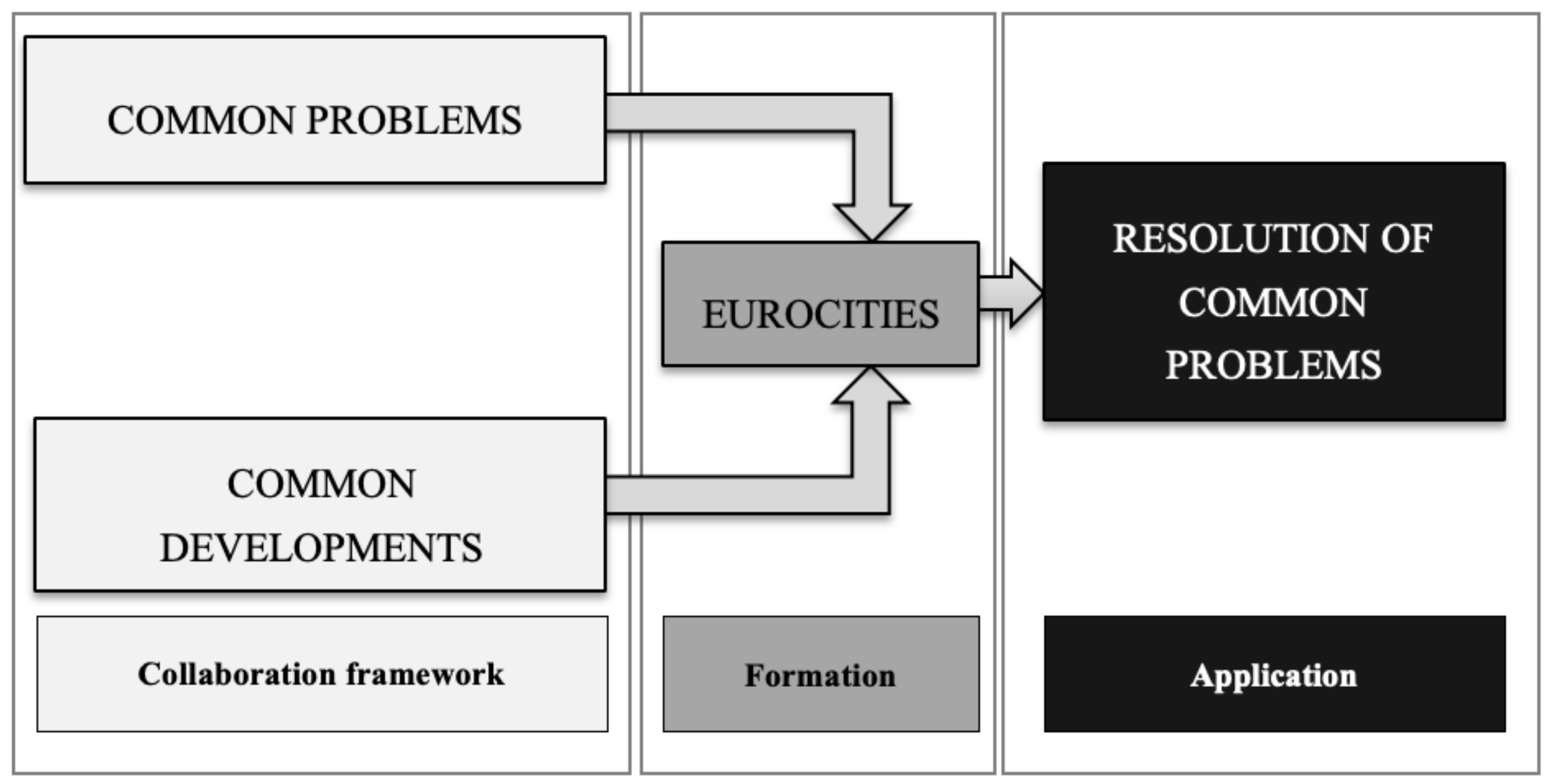
In this regard, it is necessary to consider that they are imaginary and paradoxical spaces because they are formed by several cities from different countries and arise to solve common problems. Additionally, they are in constant evolution, pretending to achieve common development (
Figure 3).
4.2. Common Development
One of the fundamental objectives of Eurocities is to achieve common development between cities that constitute them. Furthermore, these regions are able to play their role in favour of more common growth. Moreover, it is possible to achieve greater competitiveness, exchanging ideas and best practices at the same time [
65]. Thus, the results obtained show a favourable territorial cooperation with clear synergistic effects on results.
In this respect, the principle is based on sharing resources and synergies for the joint promotion, trying to achieve long-term, greater mutual cohesion and a higher level of development in the region [
66,
67]. Thus, the characteristics and aspects of this cooperation are established—which entail greater territorial cohesion.
According to Hamedinger and Wolffhard (2010): ‘the interplay between actors and institutions on the European and the city level, which leads to changes in local politics, policies, institutional arrangements, discourse, actors’ preferences, values, norms and belief systems on both levels’.
From this perspective, a network is needed whose term is widely used in the literature to cover different disciplines and contexts based on transport, telecommunications, infrastructures and policies [
68,
69]. Thus, a global vision was obtained to characterize the cohesion factors of the Eurocities. Subsequently, through the obtained results the key factors in the analysed cases were obtained.
In this regard, transport and infrastructure are necessary to achieve development. Good territorial accessibility, both between the cities that make up the Eurocity and between it and the rest of the cities, provides development opportunities [
68,
70,
71]. In fact, the connectivity to sustain the movement between cities was demonstrated as a critical factor in the Eurocity Elvas-Badajoz [
70]. Even in Baiona-San Sebastián, an intermodal Euro-corridor has been developed, public transport has been strengthened, and private transport has been controlled.
Additionally, in the Eurocities an identified critical factor in the availability of diverse infrastructures, not only focused on transport infrastructure. For example, some cross-border spaces have been created in Chaves-Verín, socio-cultural infrastructures aimed at users of both countries, and in Baiona-San Sebastián the creation of a basic axis was to develop competitive public services to valorise and balance the urban fabric. This fact is significant since it shows a symbolic conversion of the urban planning carried out in the Eurocities. Furthermore, in Chaves-Verín, from the cultural perspective, the Cultural Agenda of the Eurocity was developed, which, since 2008, unifies the cultural offer between Verín and Chaves. In addition, there are sports activities, training, education, tourism, and joint trade.
Regarding territorial accessibility as one of the determining factors of the EU work programs to rethink the borders between the Member States, they are based on a development model whose fundamental axis would be tourism. In this way, tourism has officially become one of the fundamental axes of development promoted by the EU also in the Eurocities. ‘
The infrastructure created for tourism contributes to local development, and jobs are created or maintained even in areas where industrial or rural decline, or that are in the process of urban regeneration. The need to improve the attractiveness of the regions serves as an incentive for an increasing number of destinations and stakeholders to promote more sustainable and positive practices and policies regarding the environment’ [
72].
Additionally, within the political context, the development of a strong territorial strategy and a joint and orderly planning among the component cities of the Eurocity have been recognized as critical factors in general [
62]. Specifically, in the Eurocity of Elvas-Badajoz they are recognized as critical factors as they increase the sense of belonging, have common objectives and master plans, reach a stronger political commitment, citizen participation, political transparency and commitment. In fact, it is shown that in the Eurocity Baiona-San Sebastián there are not only political-administrative obstacles, but lack of willingness to develop this Eurocity conveniently [
73].
From an economic perspective, it has been generally determined in the Eurocities as critical factors to increase access to European funds, to achieve a stronger economy and achieve better standards of life. In that way, it would be possible to attract young and talented people. Additionally, to carry out a greater marketing and publicity of the Eurocity is understood as a critical factor. For this reason, some of them, such as in Chaves-Verín, carry out activities such as publishing a monthly cultural agenda, publishing a quarterly newsletter, joint publications (tourist guides, leaflets, etc.), disseminating news through of local and regional media, use of new technologies such as Facebook and Twitter and participation in fairs.
Likewise, environmental conservation is recognized as a critical factor in environmental conservation in a general way and specifically, the generation, maintenance, and conservation of green spaces.
Additionally, it is noteworthy that in all the analysed Eurocities there is a common objective from the point of view of telecommunications—being a key in the development of them information, marketing and advertisement around the Eurocity project. In this way, the need for the development of new tools related to information flows worldwide is met.
Likewise, in some Eurocities there have been attempts to project new values based on the rehabilitation of representative buildings, with the intention of redesign them in a new cross-border scenario, as in the case of Chaves-Verín.
4.3. Formation of Eurocities
The Eurocities are built due to the development of policies between state borders that are within the EU legislative framework, which aims to achieve the Europizaiton of the regions. In fact, these were born as a result of agreements between neighbouring municipalities, historically linked but belonging to different territories of the EU [
74]. This political framework could not be ignored in the results obtained. In fact, this is basic and fundamental since it is the European legislative framework that supports and generates the creation of Eurocities.
In this regard, the EU is a source of funding for the development of border activities, with the aim of promoting cross-border networks. Even the implementation of specific plans of action at the borders opens a process of re-signification of the practices of cross-border cooperation since it is intended to achieve the same regional identity.
Precisely, this cross-border regionalization aims for Eurocities to become true institutional structures, as a consequence of a greater institutional endowment. It is in this way, that a greater spatial socialization is achieved as the borders go being territorial and political delimitations to areas of inter-regional connection, interdependence and cooperation [
75,
76].
4.4. Disadvantages or Blockages of the Eurocities
Sometimes there are management problems, as each country has its own systems and administrative controls. This fact makes the resolution of common problems and a greater process of socialization incompatible.
In this regard, the purpose would be to consolidate an area with community access of citizens residing in the different cities that make up each of the Eurocities to common services in terms of culture, education, and health.
However, the particular management of the countries has impeded this community access. In fact, the differentiated cultural management of each country has prevented greater collaboration. Likewise, differentiated educational management has prevented the community use of educational facilities such as schools and institutes for regulated and universal training in different countries. Additonally, the health management of the different countries has meant that there is currently no common health card that allows the use of health facilities on a frequent and regular basis for treatment and continued care for a long period of time for resident citizens in a different country from where the sanitary facilities are located.
In addition, the different tax regimes between the different countries that make up each Eurocity do not allow a common control in these cross-border regions. A clear example is the activities related to vehicle traffic between different countries, even subject to different regulations.
In this regard, a possible solution would be for EU legislation to be implemented at the local level in each of the cities that make up the Eurocities.
4.5. Critical Factors Identified in Iberian Eurocities
For better understand which are the barriers, obstacles and opportunities some Iberian Peninsula Eurocities projects will be briefly analysed in the following.
4.5.1. The Accessibility and Connectivity—Movement between Cities, the Euro-City Elvas–Badajoz
The Euro-city Elvas-Badajoz is a CBC project, located in the Euro-Region EUROACE (EUROACE is a Euro-Region with respect to the Portuguese regions of Alentejo and Centro, and also the Spanish region of Extremadura.) [
77], that aims to link these two cities. During the planning project of the Euro-city Elvas-Badajoz, the CBC project targeted several areas, such as economy, culture, recreation, tourism, trade, and employment, among others. In 2013, a protocol between the cities of Elvas and Badajoz was signed, leading to the creation of the Euro-city Elvas-Badajoz. This culminated in creating the highest population area around Portuguese-Spanish border heart, through the union of Elvas, Alto Alentejo (Portugal), and Badajoz, in the Extremadura Region (Spain) [
19]. According with Rossetti [
78]: “
These urban areas have special problems due to the fact that their position increases the complexity of their problems: the movement of workers towards cross-border industrial and business areas, road congestion, land use and property interactions, additional costs of non-urban centre areas and cross-border institutional, administrative and legal differences”. Furthermore, previous studies—see Castanho et al. [
6], have defined that issues, such as public transportation/movement between cities, political commitment and cooperation between municipalities, and health, are considered by the Euro-city residents as not being adequately addressed. Moreover, none of the assessed issues was qualified as great, giving the idea that no one is totally satisfied with the results obtained with the creation of this Euro-city. In fact, these results should be understood as an alarm sign with respect to the future of this CBC project. Confronting those results to the ones obtained throughout the present research, it is possible to say that a sustainable development of the territory, especially regarding to transportation is still a far horizon to Elvas-Badajoz. Once, according with Transport for Sustainable Development principles (2015): “
transport systems improvements should aim at ensuring equitable access for citizens to reach desired destinations (services, healthcare, recreation) and access opportunities (employment, education), regardless of individual wealth, age, gender or possible health conditions resulting in reduced mobility”, which is not verified in the Euro-city Elvas-Badajoz.
4.5.2. The Diverse Infrastructural Offer—Euro Citizenship, the Euro-Cities of Chave–Verín and Tuy–Valença
Those two CBC projects aims to increase the accessibility between cities and strengthen their common space—i.e., housing, employment, recreation, etc. The border territory is publicized along with the Tamega River. With the strategically agenda established in 2008, three pillars have been defined: (i) euro-citizenship; (ii) sustainable territory; and (iii) economic growth, fostering to reach a smart city [
79]. Against the exodus that young people are demonstrating on the region, the cities developed a strategy to attract young and talented entrepreneurs to the territory through generating a well-planned employment dynamic able to foster an investor’s magnet, leading to a final solution, the establishment of the Eurocity. Since then, the cities have worked together along with national, regional and local authorities towards the implementation of common services and also to give an answer to common problems. Euro-citizenship has been created, allowing the residents of both cities to take advantage of the benefits from each city. The possibility to create a transboundary health card, which allows the citizens to benefit the health services from the neighbouring cities is one of the future goals of this CBC project. However, besides all the great indicators this synergy shows, in the Portuguese-Spanish border there are still the obstacles which somehow break the cooperation in some sectors as the issue of differences in political administrations, which may be outdated by an even stronger political commitment [
80]. Nevertheless, and according to public and experts’ perceptions, the so-called positive results found in this CBC strategy are on a large-scale achieved by the efforts carried out by the cities on marketing and advertisement around the Eurocity [
79].
Being rural areas with a low density of population, the councils, fostering to promote the economy, have established an agreement for the creation of a Eurocity. Similar to what occurs in Chaves-Verín, this CBC project also aims to cover the same issues, those two Eurocities—Chaves-Verín and Tuy-Valença are the nearest Eurocities in Iberian Peninsula, which suggests that they are facing the same problems and are also using similar CBC strategies [
81]. One of these examples is the issue of differences in political administrations among the countries. Additionally, they are in the case of Chaves-Verín, here in Tuy-Valença the cities gather efforts to create Euro-citizenship for their populations, and allows them to benefits as it occurs in the neighboring Eurocity. However, this CBC project has plans to go further with the intentions to create a common policy task force.
4.5.3. The Citizen Involvement, Vila Real de Santo António–Ayamonte
The border municipalities of Vila Real de Santo António (Portugal) and Ayamonte (Spain) constituted in 2013 the first South Iberian Eurocity [
82,
83]. The Guadiana River is the linkage between these two cities since it was through this waterway that the relations among the localities were cemented and bonds created throughout history. As the River, and the international bridge, common features to Portugal and Spain, are the branding and logo of the Eurocity—whose graphic composition and colours represent the Iberian union of the cities combining tradition with the future [
82].
The establishment of the Eurocity comes in the scope of the CCDR-Algarve Agenda allied to the goals of the Euroregion Alentejo-Algarve-Andaluzia [
84]. This Eurocity is a CBC project which goes beyond institutional cooperation and aims to strengthen the existing link between municipalities, exemplifying a new model of cooperation and promoting economic, social, cultural, tourism, and environmental convergences between the territories; aiming to avoid the resources and equipment duplication, through a planning and joint management system among municipalities [
85].
In this regard, and according to [
86], the main goals of this Eurocity are: to promote local human resources; foster the value of the natural and heritage features; strengthen the economic regional basis through a higher investment in local entrepreneurs; contribute to a more balanced management of public funds; foster an approach towards the EU standards and integration policies; develop common marketing, advertisement, and tourism strategies; foster the sharing of equipment and resources; and promote the public participation in CBC processes.
4.5.4. Summary of the Identified Factors in the Iberian Eurocities
In order to better understand the main factors that are influencing the success of Eurocities projects and strategies on Iberian Peninsula, the following table was developed (
Table 3).
Throughout the analysis of
Table 3 is possible to understand that not all the same factors influences the success of every Eurocity—leading to need that each project needs to be understand and approach individually, according with their own particularities and specificities.
The
Table 3 is the result of the analysis of previous studies conducted on Cross-Border Cooperation Projects and Strategies on EU territories [
6,
21]. Those studies analysed several CBC case studies, including the Iberian Eurocities. Thus, those Iberian Eurocities were isolated and their critical factors to achieve territorial success were grouped and summarized in the above table.
Through
Table 3, it is possible to verify that in Iberian Eurocities there are five critical factors to be considered by the main-actors—i.e., decision makers, politicians, urban planners, architects, etc. The identified factors could only be achieved by structural changes in the Eurocities governance strategies—i.e., policies, planning approaches, citizen demands, etc. In fact, those factors reflect the gaps verified in the analysed case studies.
5. Discussion and Conclusions
The historical and social evolution, whether of Spain or Portugal, as demonstrated over time, and the ownership and use of the territories and their landscapes are the result of the administrative policies and actions carried out [
9]. In this regard, consolidating the urban agglomerations and giving them the consistency resulting from regional laws and policies, today, reflects the plurality of the entire peninsula [
9]. Contextually, the process is produced by means of which different cities but geographically close (even if they are located in different countries), can be integrated more functionally. Developing in common an integration in variated aspects, such as transport, culture, tourism, services offered to citizens, and infrastructures; besides, these cities can develop common policies.
Thus, those urban and territorial methodologies and tools were (and continue to be) the basic guidelines for the development—in fact, the common development is not an exception. Thus, considering those territorial and urban policies are the guidelines for the development on both sides of the border when such a common project as a Eurocity project is considered, those methods, tools, and policies will influence the direction of the Eurocity project regarding their planning and implementation. Therefore, a strict relationship between planning methodologies, tools, and public policies and the Eurocities conception is verified. As mentioned above, even if the Eurocity model is not the best way to develop cross-border cooperation in each case, some cities, especially in Central Europe, are already inspired by it and trying to use it as a basis for their own activities. An example of this is the cities of Cieszyn and Czech Cieszyn, on the Polish-Czech border, which are currently implementing a cross-border project whose aim is to strengthen cooperation structures on principles similar to the Eurocity. The adaptation of solutions from the Iberian Peninsula in Central Europe will be the subject of our further research. In fact, as future research, the authors expect to analyse which elements of the Eurocity model will be taken over in Central Europe and how the new Polish-Czech Eurocity will develop in other socio-economic conditions.
Through the performed historical review regarding the evolutionary process of urban planning in Iberian Peninsula, it is observed that new strategies, methods, approaches, and projects are needed in order to optimize and adapt to new demands—the realities of the 21st century are accentuating more and more in the urban landscape of “new times”, both at the technological level, as well as at the socio-economic level.
Furthermore, the cities development dynamics and the public policies carried out over border areas has led to some major issues on both sides of the border—i.e., high unemployment rates, population exodus (mainly young and talented people), lack of accessibility and connectivity infrastructures’, among many others; such issues have resulted in the cities joining efforts through CBC projects and strategies (Eurocities) to face them—i.e., through the development of common objectives and master plans, avoiding infrastructural duplication, creating conditions to retain young and talented people, increasing the economy and, consequently, the quality of life standards of the inhabitants, are just some examples of the high sustainable development power of the synergies created by the combination of effort. An effective policy of sustainable development in border cities must take into account the synergistic use of shared resources and their allocation in order to achieve harmonious development on both sides of the border, not only in one part of the border area. It is very difficult, as competition between cities is still dominating. Despite declaring cooperation, it is often competition for resources. Therefore, the Eurocity model can be an inspiration to develop such cooperation in a sustainable way and achieve much better multiplier effects, based on the resources of partners and their cooperation.
In fact, this process could be identified more often in the Iberian Peninsula than in other European regions—and it took place (in the Iberian Peninsula) after the process of democratization followed in Spain and Portugal. For this reason, it is understood as a process of common spatial socialization between different cities, although these are found in different countries of the Iberian Peninsula. Thus, a wide range of transformative and harmonization processes are produced, since the common feeling of collaboration is stronger than separation by an imaginary line that constitutes the border. Moreover, all those changes were, in several cases, leading the countries and regions to get close and define strategies to facing common problems, such as social polarization, social exclusion, and social segregation. The phenomena of the Eurocities projects are seen as some of the most evident cases of such cooperation, and are considered as some of the most pioneering projects in the European Union. Moreover, the genesis of a Eurocity may be found in the necessity that regions and countries haveto face common problems through common strategies.
Indeed, the Eurocity is understood as the cooperation project carried out in a “territorial cooperative” space—constituting a common action territory. In this sense, the axes of creation and functioning of the Eurocity are composed by a base project evaluated and complemented by a discussion regarding its incidence and also considering the multiple cross-border implications and impacts—since it is intended to achieve an institutional, social convergence, cultural and environmental. Thus, to achieve such a successful project it is necessary to consider the border not as an obstacle, but as an opportunity to achieve territorial and socio-economic development. Therefore, there is a need to articulate a joint project between actors on both sides of the border, but in which the participation of the local population (public participation) is also important.
The present research enables us to determine which critical factors acts over the Iberian Eurocities, through the analysis of CBC projects in the Iberian Peninsula Eurocities, giving important insights to future developments in this area. Nevertheless, is important to note that some of these factors have already been identified in previous studies as being specific to the Iberian border, such as the one put forward by Medeiros [
84] on the scope of the analysis of the first INTERREG-A (INTERREG are programmes aiming to stimulate the cooperation between regions in the European Union, INTERRAG-A is one of the mentioned programmes that operates in the Euroregion EuroACE.) program (1989–1993) [
85]. Moreover, other studies—see Castanho et al. [
86]—reach similar results, where it is stated that: “
As the case studies of Chaves-Verín, Tuy-Valença, and Vila Real de Santo António-Ayamonte, share a considerable number of characteristics and similarities with the case of the Eurocity Elvas-Badajoz, and even match with the pre-established selection criteria, future solutions and developments found in some of those case studies should be taken into account by policy-makers, planners, researchers and other main actors in this procedure, particularly when the time comes for decision-making about common problems, fostering correct and sustainable growth for all Iberian CBC areas”.
Based on the exposed, the research questions could be answered: “could those planning methods, through the creation of Eurocities provide an answer to common issues?”; thus, through a theoretical perspective, yes they could—nevertheless, in most of the examined cases when it comes to the practice the answer is not as so positive. In fact, cooperation in the Eurocity model is not yet widely used. These first examples of Eurocities should inspire how it can be developed in other cities. A similar situation took place in Euroregions. The first emerging Euroregions also did not develop ideally—sometimes they were far away from theoretical assumptions. Even today, individual Euroregions are also different from each other. On the other hand, there is agreement on the complexities of the Euregionalisation process and different possibilities of its implementation. Nevertheless, cross-border cooperation in the Eurocity model is not conducted in a sufficient way in border areas in Europe, although it is a relatively new, attractive formula of territorial cooperation, which optimizes the use of resources and potentials of cooperating cities and regions. The development of a set of recommendations regarding methods, tools, and strategies for implementing cooperation in the Eurocity model will be beneficial for those cross-border regions that would like to take advantage of such opportunities.


