Editorial

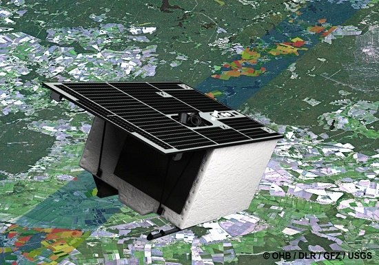
Preface: The Environmental Mapping and Analysis Program (EnMAP) Mission: Preparing for Its Scientific Exploitation

1
Section 1.4 Remote Sensing, Helmholtz Center Potsdam GFZ German Research Center for Geosciences, Telegrafenberg, 14473 Potsdam, Germany
2
Laboratoire de Planétologie et Géodynamique de Nantes, University of Nantes, 2 rue de la Houssinière, BP92208, 44322 Nantes Cedex 3, France
3
ESA-ESRIN, Via Galileo Galilei, 00044 Frascati, Italy
4
Alberta Terrestrial Imaging Centre and Department of Geography, University of Lethbridge, 4401 University Drive, Lethbridge, AB T1K 3M4, Canada
*
Author to whom correspondence should be addressed.
Submission received: 15 November 2016 / Accepted: 15 November 2016 / Published: 17 November 2016

Abstract

:
The imaging spectroscopy mission EnMAP aims to assess the state and evolution of terrestrial and aquatic ecosystems, examine the multifaceted impacts of human activities, and support a sustainable use of natural resources. Once in operation (scheduled to launch in 2019), EnMAP will provide high-quality observations in the visible to near-infrared and shortwave-infrared spectral range. The scientific preparation of the mission comprises an extensive science program. This special issue presents a collection of research articles, demonstrating the potential of EnMAP for various applications along with overview articles on the mission and software tools developed within its scientific preparation.

Graphical Abstract

1. Introduction

Imaging spectroscopy has been demonstrated to be a powerful tool for numerous environmental applications [1,2,3]. So far, research has mainly been based on airborne hyperspectral image data with restricted spatial and temporal coverage, while spaceborne imaging spectroscopy has been strongly limited by data availability. Successful technology demonstrators include NASA’s Hyperion launched in 2000 [4], ESA’s CHRIS launched in 2001 [5], MERIS on Envisat operated from 2002 to 2012 [6], and NASA’s HICO on the international space station operated from 2009 to 2015 [7], among a few others.
The future German imaging spectroscopy mission EnMAP (Environmental Mapping and Analysis Program) will represent a milestone towards high-quality hyperspectral observations of terrestrial and aquatic ecosystems from space. It will enable the derivation of bio-chemical and bio-physical variables with an accuracy not achievable by current optical broadband satellite sensors. As such, EnMAP is destined to make a major contribution toward quantifying and modeling crucial ecosystem processes and understanding the complexities of the Earth system. More specifically, the primary goals of the mission are to investigate globally interconnected environmental processes and changes, to study the diverse effects of anthropogenic impacts on ecosystems, and to support the sustainable management of natural resources.
EnMAP will record more than 240 narrow spectral bands in a spectral range between 420 nm and 2450 nm with a signal-to-noise ratio of 400:1 in the visible to near-infrared and 180:1 in the shortwave-infrared range at a reference radiance level [8]. EnMAP will cover a 30 km swath with a ground sampling distance of 30 m and a total image data acquisition length of 5000 km per day [9]. The scientific preparation of the mission includes an extensive science program dedicated to demonstrate the scientific potential of future EnMAP data, develop image processing tools for efficient data processing, and build an expert community to ensure exploitation of the full information content of EnMAP data once operational.
In the framework of the EnMAP preparatory program, a large number of hyperspectral airborne flight campaigns are carried out to support scientific application development in a wide range of environments. The datasets are made freely available to the scientific community [10]. Furthermore, preparatory activities involve the simulation of the entire image generation and processing chain using the EnMAP end-to-end scene simulator (EeteS) [11]. EeteS comprises four main modules (atmospheric, spatial, spectral, and radiometric) to generate EnMAP-like data products. The simulated data facilitate the development of pre-processing algorithms as well as algorithms for the retrieval of surface information for various applications. As part of the scientific preparation, the EnMAP-Box, a free software toolbox that is specifically designed for handling future hyperspectral spaceborne data, is being developed [12]. It provides basic processing and visualization functionalities as well as advanced approaches for image analysis.
This special issue aims to give an overview of the EnMAP mission and ongoing research conducted in the scientific preparation of the mission to demonstrate the potential of future EnMAP data for a range of application areas, namely forestry, agriculture, inland and coastal waters, soils, and natural ecosystems. The following section provides a brief summary of the 14 articles published within the special issue.

2. Overview of Contributions

Guanter et al. [8] provide a comprehensive overview of the EnMAP imaging spectroscopy mission and its current status, including a brief description of the mission and instrument requirements, mission organization, components of the space and ground segment, the science program, as well as on-going preparatory activities.
To study the potential of future spaceborne EnMAP image data for a range of applications, the contributions in this special issue make use of simulated future EnMAP data generated from airborne acquisitions. Furthermore, several studies in this issue focus on the comparison with other missions, such as Sentinel-2, and discuss their potential synergetic use.
Managing and process-based modeling of forest ecosystems may strongly benefit from information gained from future spaceborne imaging spectroscopy missions such as EnMAP. Dotzler et al. [13] and Clasen et al. [14] analyzed the information content of EnMAP and Sentinel-2 data for detecting drought stress and quantifying crown component fractions in temperate deciduous forest ecosystems. Dotzler et al. [13] demonstrated that, different from other water- and chlorophyll-sensitive indices, the photochemical reflectance index (PRI) applied to simulated EnMAP data was able to detect drought plant stress at the time of observation. However, this could not be reproduced with simulated Sentinel-2 data due to missing spectral bands. Clasen et al. [14] applied a multiple endmember spectral mixture analysis (MESMA) approach to determine canopy components, including not only leaf and soil but also bark fractions on different spectral scales.
The retrieval of accurate biochemical and structural vegetation properties, such as the leaf area index (LAI) and their seasonal development, is of high relevance for agricultural management. Locherer et al. [15] studied the influence of different selection criteria in the model inversion process of the PROSAIL model on the retrieval of seasonal LAI without using prior information. In contrast to this physically based model approach, Siegmann et al. [16] applied empirical models to predict the LAI of winter wheat based on pan-sharpened EnMAP data using panchromatic bands from airborne AISA Eagle and Sentinel-2 satellite data.
Natural ecosystems are characterized by highly heterogeneous surface covers and gradually changing cover fractions. Leitão et al. [17], Suess et al. [18], and Malec et al. [19] demonstrated the benefit of future high-quality spaceborne imaging spectroscopy data for characterizing and quantifying natural ecosystems and gradual transitions. Leitão et al. [17] explored the usage of multi-date narrow-band spectral indices to estimate vegetation cover fractions by fitting boosted regression tree models, while Suess et al. [18] and Malec et al. [19] studied the potential of sub-pixel cover fraction estimation using synthetic mixtures in an adapted support vector classification model parameterization and a MESMA approach, respectively.
Future spaceborne imaging spectroscopy missions, such as EnMAP, will open up new opportunities for monitoring coastal and inland waters including the differentiation of phytoplankton taxonomic groups. Xi et al. [20] tested the differentiation capabilities of phytoplankton taxonomic groups using remote sensing reflectance directly compared to absorption spectra derived from inversion models.
Besides the application-based contributions, several articles deal with techniques for assessing and enhancing future EnMAP image data quality. Bachmann et al. [21] assessed the influence of the expected radiometric and spectral calibration stability on the uncertainty in the future EnMAP ground reflectance product. Cerra et al. [22] proposed an unmixing-based denoising approach to correct future EnMAP image data, acquired under unfavorable illumination conditions and off-nadir viewing angles. To facilitate applications requiring higher spatial resolutions while maintaining the high spectral resolution, Yokoya et al [23] investigated the potential of fusion-based resolution enhancement using simulated EnMAP and Sentinel-2 data. In particular, they investigated the performance of a matrix factorization technique in comparison with two pan-sharpening techniques for improved mineral mapping capabilities.
As part of the EnMAP scientific preparation program, image processing software is under development, aiming to provide free access to pre-processing and application-based imaging spectroscopy tools for a growing hyperspectral community. Van der Linden et al. [12] provide an overview of the concept and functionality of the EnMAP-Box, while Mielke et al. [24] introduce EnGeoMAP 2.0, an expert system for mineral identification.

3. Conclusions

This special issue provides an overview of the EnMAP mission and ongoing research conducted in the scientific preparation of the mission y. EnMAP and other upcoming imaging spectroscopy missions, such as HyspIRI [25], HISUI [26], PRISMA [27], HYPXIM [28], and SHALOM [29] will deliver valuable information for various environmental applications towards a better understanding of ecosystem processes and sustainable resource management. When operating in parallel, these missions will allow for an increased spatial coverage and acquisition frequency of hyperspectral spaceborne imagery. Furthermore, several authors in this issue stress the importance of developing concepts for the synergetic use of EnMAP and Sentinel-2 satellite data. One major advantage is the proposed spatial resolution enhancement by image fusion while maintaining a high spectral resolution. The increase in both temporal coverage and spatial resolution will be beneficial for many environmental applications and may even hold potential for new applications of spaceborne imaging spectroscopy that have not yet been anticipated.

Acknowledgments

The guest editors would like to thank all authors for their excellent contributions, the reviewers for their valuable and timely reviews, and the Remote Sensing editorial team for their support. Most of the research contained in the special issue was funded within the EnMAP scientific preparation program under the DLR Space Administration with resources from the German Federal Ministry of Economic Affairs and Energy.

Conflicts of Interest

The authors declare no conflict of interest.

References

  1. Goetz, A. Three decades of hyperspectral remote sensing of the Earth: A personal view. Remote Sens. Environ. 2009, 113, 5–16. [Google Scholar] [CrossRef]
  2. Schaepman, M.E.; Ustin, S.; Plaza, A.; Painter, T.; Verrelst, J.; Liang, S. Earth system science related imaging spectroscopy—An assessment. Remote Sens. Environ. 2009, 113, 123–137. [Google Scholar] [CrossRef]
  3. Thenkabail, P.; Lyon, J.; Huete, A. (Eds.) Hyperspectral Remote Sensing of Vegetation; CRC Press: Boca Raton, FL, USA, 2012; p. 782.
  4. Ungar, S.G.; Pearlman, J.S.; Mendenhall, J.A.; Reuter, D. Overview of the earth observing one (EO-1) mission. IEEE Trans. Geosci. Remote Sens. 2003, 41, 1149–1159. [Google Scholar] [CrossRef]
  5. Barnsley, M.J.; Settle, J.J.; Cutter, M.; Lobb, D.; Teston, F. The PROBA/CHRIS mission: A low-cost smallsat for hyperspectral, multi-angle, observations of the Earth surface and atmosphere. IEEE Trans. Geosci. Remote Sens. 2004, 42, 1512–1520. [Google Scholar] [CrossRef]
  6. Rast, M.; Bézy, J.L.; Bruzzi, S. The ESA Medium Resolution Imaging Spectrometer MERIS—A review of the instrument and its mission. Int. J. Remote Sens. 1999, 20, 1681–1702. [Google Scholar] [CrossRef]
  7. Lucke, R.L.; Corson, M.; McGlothlin, N.R.; Butcher, S.D.; Wood, D.L.; Korwan, D.R.; Li, R.R.; Snyder, W.A.; Davis, C.O.; Chen, D.T. Hyperspectral imager for the coastal ocean: Instrument description and first images. Appl. Opt. 2011, 50, 1501–1516. [Google Scholar] [CrossRef] [PubMed]
  8. Guanter, L.; Kaufmann, H.; Segl, K.; Foerster, S.; Rogass, C.; Chabrillat, S.; Kuester, T.; Hollstein, A.; Rossner, G.; Chlebek, C.; et al. The EnMAP spaceborne imaging spectroscopy mission for earth observation. Remote Sens. 2015, 7, 8830–8857. [Google Scholar] [CrossRef]
  9. Kaufmann, H.; Sang, B.; Storch, T.; Segl, K.; Foerster, S.; Guanter, L.; Erhard, M.; Heider, B.; Hofer, S.; Honold, H.-P.; et al. Environmental mapping and analysis program—A German hyperspectral mission. In Optical Payloads for Space Missions; Qian, S.-E., Ed.; Wiley: Chichester, UK, 2016; pp. 161–182. [Google Scholar]
  10. EnMAP Flight Campaigns. Available online: www.enmap.org/?q=flights (accessed on 15 November 2016).
  11. Segl, K.; Guanter, L.; Rogaß, C.; Küster, T.; Roessner, S.; Kaufmann, H.; Sang, B.; Mogulsky, V.; Hofer, S. EeteS—The EnMAP End-to-End Simulation Tool. IEEE J. Sel. Top. Appl. Earth Obs. Remote Sens. 2012, 5, 522–530. [Google Scholar] [CrossRef]
  12. Van der Linden, S.; Rabe, A.; Held, M.; Jakimow, B.; Leitão, P.; Okujeni, A.; Schwieder, M.; Suess, S.; Hostert, P. The EnMAP-Box—A toolbox and application programming interface for EnMAP data processing. Remote Sens. 2015, 7, 11249–11266. [Google Scholar] [CrossRef]
  13. Dotzler, S.; Hill, J.; Buddenbaum, H.; Stoffels, J. The potential of EnMAP and Sentinel-2 data for detecting drought stress phenomena in deciduous forest communities. Remote Sens. 2015, 7, 14227–14258. [Google Scholar] [CrossRef]
  14. Clasen, A.; Somers, B.; Pipkins, K.; Tits, L.; Segl, K.; Brell, M.; Kleinschmit, B.; Spengler, D.; Lausch, A.; Förster, M. Spectral unmixing of forest crown components at close range, airborne and simulated Sentinel-2 and EnMAP spectral imaging scale. Remote Sens. 2015, 7, 15361–15387. [Google Scholar] [CrossRef]
  15. Locherer, M.; Hank, T.; Danner, M.; Mauser, W. Retrieval of seasonal leaf area index from simulated EnMAP data through optimized LUT-based inversion of the PROSAIL model. Remote Sens. 2015, 7, 10321–10346. [Google Scholar] [CrossRef]
  16. Siegmann, B.; Jarmer, T.; Beyer, F.; Ehlers, M. The potential of pan-sharpened EnMAP data for the assessment of wheat LAI. Remote Sens. 2015, 7, 12737–12762. [Google Scholar] [CrossRef]
  17. Leitão, P.; Schwieder, M.; Suess, S.; Okujeni, A.; Galvão, L.; Linden, S.; Hostert, P. Monitoring natural ecosystem and ecological gradients: Perspectives with EnMAP. Remote Sens. 2015, 7, 13098–13119. [Google Scholar] [CrossRef]
  18. Suess, S.; van der Linden, S.; Okujeni, A.; Leitão, P.; Schwieder, M.; Hostert, P. Using class probabilities to map gradual transitions in shrub vegetation from simulated EnMAP data. Remote Sens. 2015, 7, 10668–10688. [Google Scholar] [CrossRef]
  19. Malec, S.; Rogge, D.; Heiden, U.; Sanchez-Azofeifa, A.; Bachmann, M.; Wegmann, M. Capability of spaceborne hyperspectral EnMAP mission for mapping fractional cover for soil erosion modeling. Remote Sens. 2015, 7, 11776–11800. [Google Scholar] [CrossRef]
  20. Xi, H.; Hieronymi, M.; Röttgers, R.; Krasemann, H.; Qiu, Z. Hyperspectral differentiation of phytoplankton taxonomic groups: A comparison between using remote sensing reflectance and absorption spectra. Remote Sens. 2015, 7, 14781–14805. [Google Scholar] [CrossRef]
  21. Bachmann, M.; Makarau, A.; Segl, K.; Richter, R. Estimating the influence of spectral and radiometric calibration uncertainties on EnMAP data products—Examples for ground reflectance retrieval and vegetation indices. Remote Sens. 2015, 7, 10689–10714. [Google Scholar] [CrossRef]
  22. Cerra, D.; Bieniarz, J.; Müller, R.; Storch, T.; Reinartz, P. Restoration of simulated EnMAP data through sparse spectral unmixing. Remote Sens. 2015, 7, 13190–13207. [Google Scholar] [CrossRef]
  23. Yokoya, N.; Chan, J.; Segl, K. Potential of resolution-enhanced hyperspectral data for mineral mapping using simulated EnMAP and Sentinel-2 images. Remote Sens. 2016, 8, 172. [Google Scholar] [CrossRef]
  24. Mielke, C.; Rogass, C.; Boesche, N.; Segl, K.; Altenberger, U. EnGeoMAP 2.0—Automated hyperspectral mineral identification for the German EnMAP space mission. Remote Sens. 2016, 8, 127. [Google Scholar] [CrossRef]
  25. Lee, C.M.; Cable, M.L.; Hook, S.J.; Green, R.O.; Ustin, S.L.; Mandl, D.; Middleton, E.M. An introduction to the NASA Hyperspectral InfraRed Imager (HyspIRI) mission and preparatory activities. Remote Sens. Environ. 2015, 167, 6–19. [Google Scholar] [CrossRef]
  26. Iwasaki, A.; Ohgi, N.; Tanii, J.; Kawashima, T.; Inada, H. Hyperspectral Imager Suite (HISUI)—Japanese hyper-multi spectral radiometer. In Proceedings of the 2011 IEEE International Geoscience and Remote Sensing Symposium (IGARSS), Vancouver, BC, Canada, 24–29 July 2011; pp. 1025–1028.
  27. Pignatti, S.; Angelo, P.; Simone, P.; Filomena, R.; Federico, S.; Tiziana, S.; Umberto, A.; Vincenzo, C.; Acito, N.; Marco, D.; et al. The PRISMA hyperspectral mission: Science activities and opportunities for agriculture and land monitoring. In Proceedings of the 2013 IEEE International Geoscience and Remote Sensing Symposium (IGARSS), Melbourne, Australia, 21–26 July 2013; pp. 4558–4561.
  28. Michel, S.; Gamet, P.; Lefevre-Fonollosa, M.J. HYPXIM—A hyperspectral satellite defined for science, security and defence users. In Proceedings of the 2011 3rd Workshop on Hyperspectral Image and Signal Processing: Evolution in Remote Sensing (WHISPERS), Lisbon, Portugal, 6–9 June 2011; pp. 1–4.
  29. Feingersh, T.; Ben-Dor, E. SHALOM—A commercial hyperspectral space mission. In Optical Payloads for Space Missions; Qian, S.-E., Ed.; Wiley: Chichester, UK, 2016; pp. 247–264. [Google Scholar]

